Teton Crest Trail
August 22, 2020
Table of Contents
The Teton Crest Trail is a 39-mile point-to-point trail in Grand Teton Nation Park. It starts at Philips Pass at the south end of the Teton Range, and ends at String Lake. The trail is known for its stunning views of the Teton Range, mainly the Grand Teton, Middle Teton and South Teton mountains. It's truly a perfect trail for beginner backpackers because of its accessibility to water sources and camping spots. It's always a distance that is manageable for most people who have some backpacking experience.
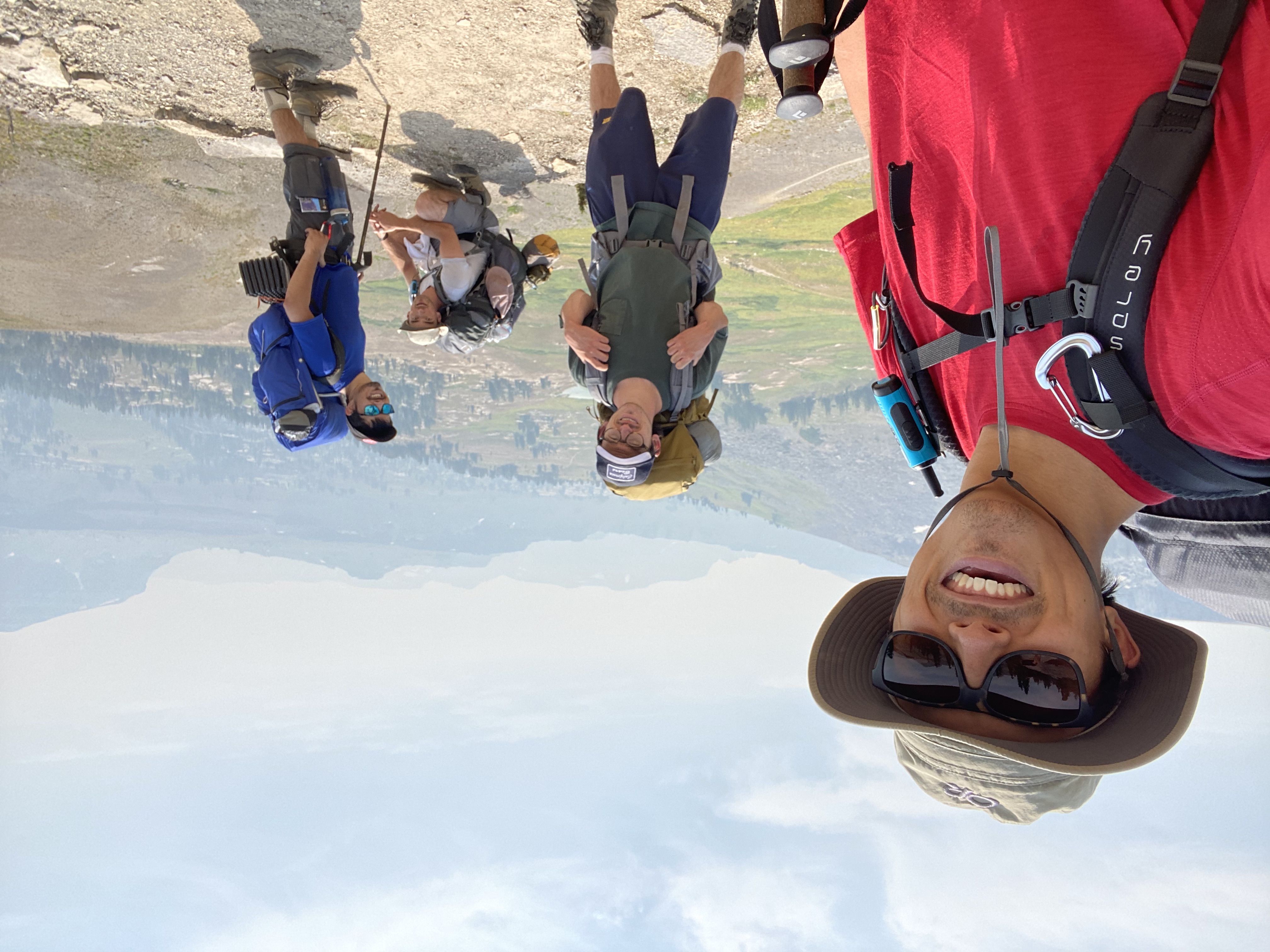
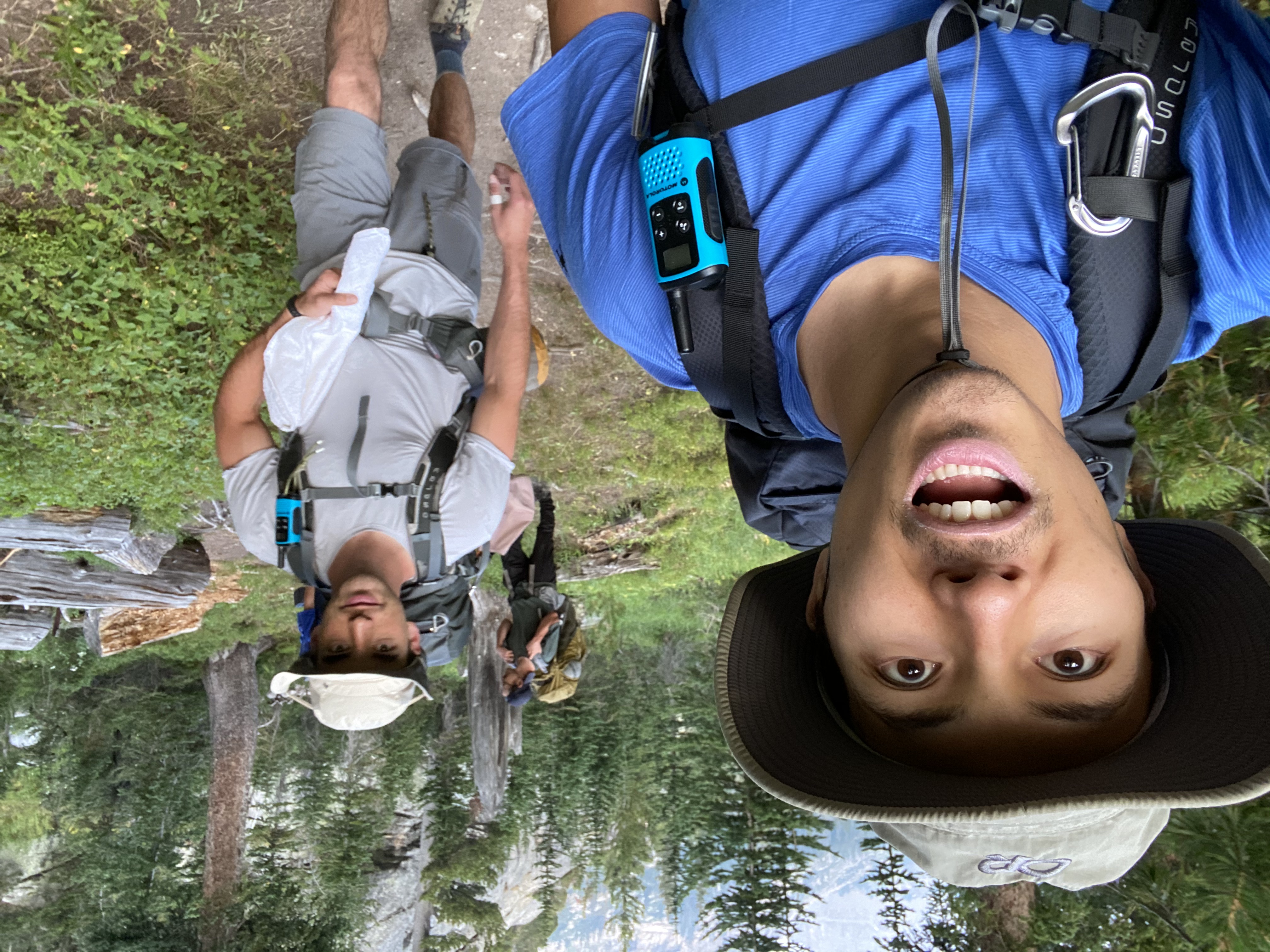
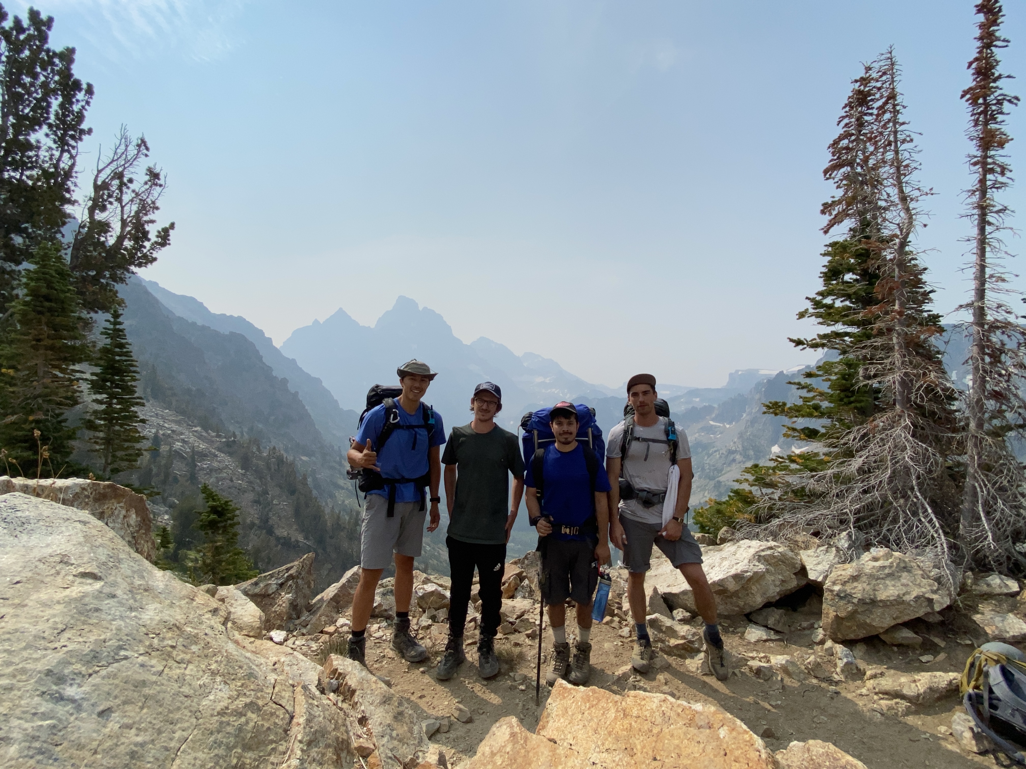
A good friend of mine plans backpacking trips every year, and I'm extremely grateful for this. I love these trips and I really cherish the memories that come from them. This year, we decided to go to the Tetons! The group consisted of Timur (he's the guy that plans these yearly backpacking trips), Willy, Ari and myself. I'd never been to Wyoming before, and I've always heard about how beautiful the Teton Range is. This trip has definitely made me want to go back, but maybe next time I'll try some of the multi-pitch climbing routes that the Tetons are known for!
Trip Plan
We planned to complete the Teton Crest Trail in 4 days and 3 nights. We would start at Granite Canyon Trailhead and hike up to meet the Teton Crest Trail near Marion Lake. The Teton Crest Trail actually starts a Philips Pass, and you can reach this point by hiking up from Philips Canyon Trailhead. If you were to go with this approach, it adds a bit driving and a bit more hiking, that we felt wasn't really worth it. Starting at Granite Canyon Trailhead seems to be the more popular option.
Note, you need a permit to camp in Grand Teton National Park. You can learn more about advanced permit reservations for Grand Teton National Park on the National Park Service website.
Daily Distances
Our rough plan:
- Day 1: 13 miles (+3,850ft, -780ft elevation) from Granite Canyon Trailhead to Death Canyon Shelf
- Day 2: 10 miles (+1,870ft, -2,700ft elevation) from Death Canyon Shelf to South Fork Cascade Canyon
- Day 3: 8 miles (+2,930ft, 2,140ft elevation) from South Fork Cascade Canyon to Holly Lake
- Day 4: 8 miles (+100ft, 2,640ft elevation) from Holly Lake to Jenny Lake
Mapping
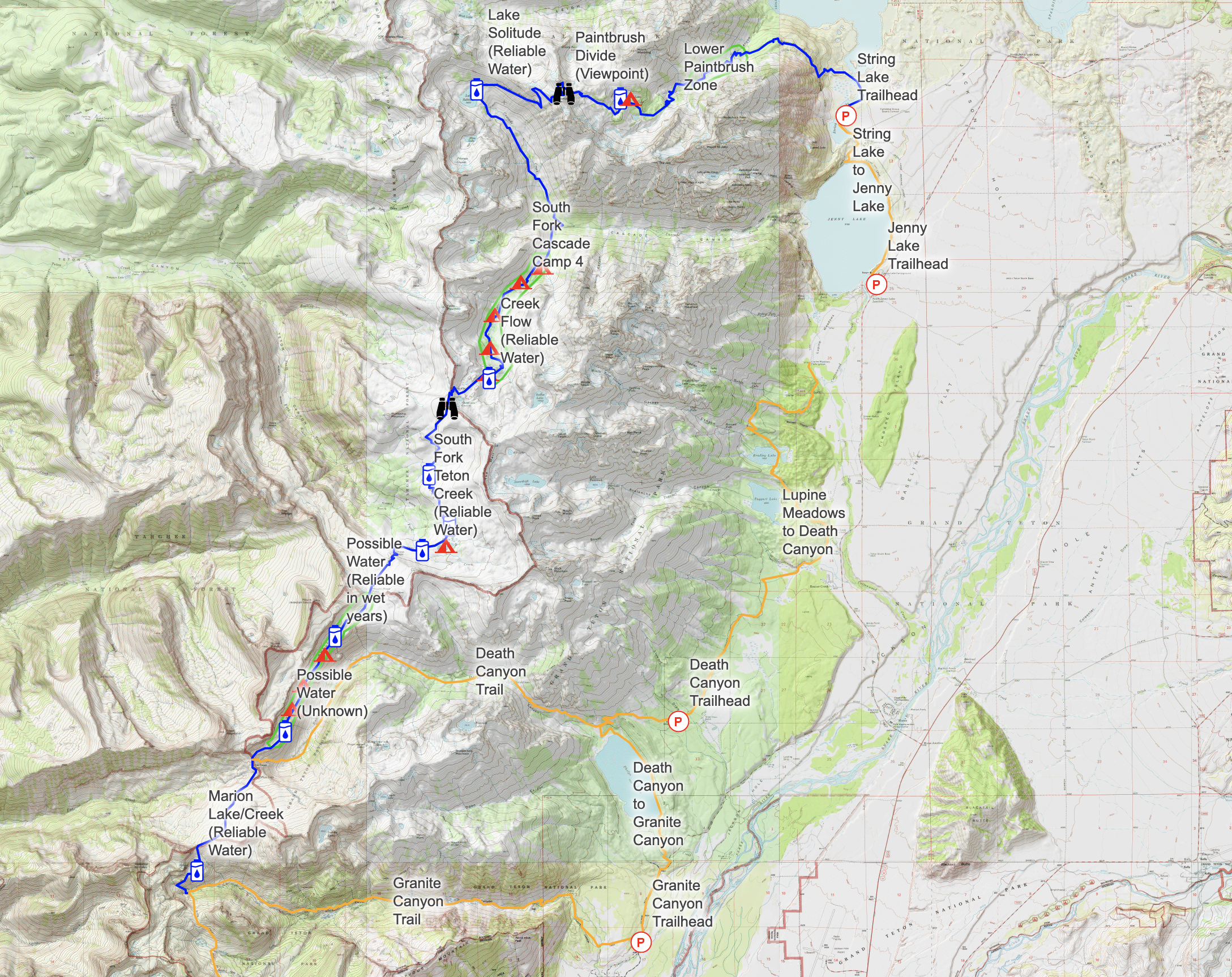
Prior to our trip, we did a fair amount of research to understand where potential water sources would be, and where exactly we might be able to camp in each of our permitted zones. There are a lot of nice tools out there but, CalTopo and GaiaGPS are my favorite mapping tools for planning backpacking trips. You can find a lot of publicly shared CalTopo maps that provide a lot of useful information. Feel free to reference my Teton Crest Trail (WY, USA) CalTopo map if you need some help planning your trip!
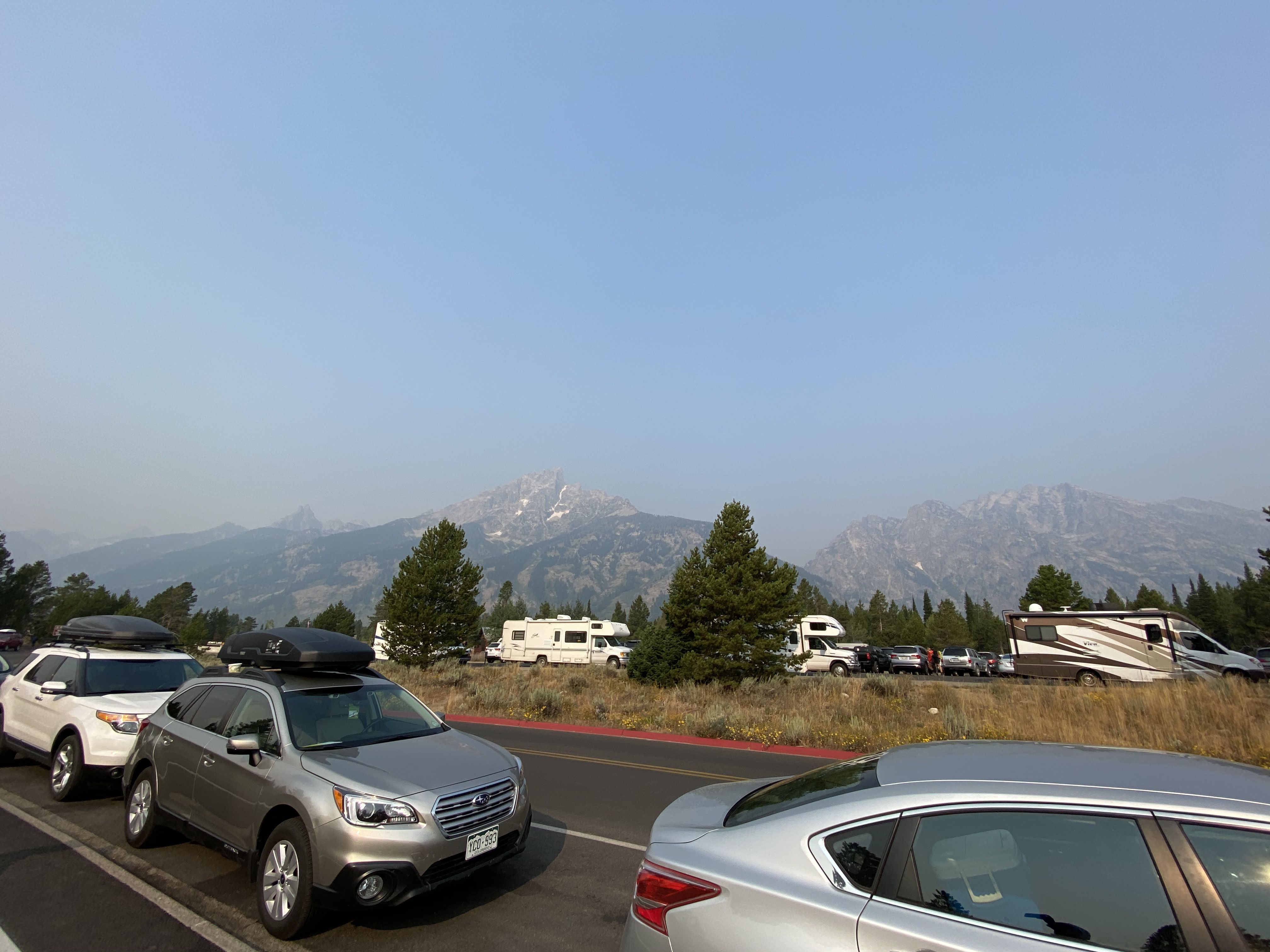
Arriving in Teton National Park
We flew into Jackson hole, rented a car and stayed at an AirBnb our first night so we could hit the trail early the next morning. We wanted to start our trip well rested, with a full day ahead of us.
The next morning, we had to stop by the Jenny Lake Ranger Station to pick up our permit. Things might have changed since our trip but, even though we had successfully made a reservation for our permit, we still had to go and pick it up in person. So, we arrived at the ranger station just before they opened and got our permits without any difficulties.
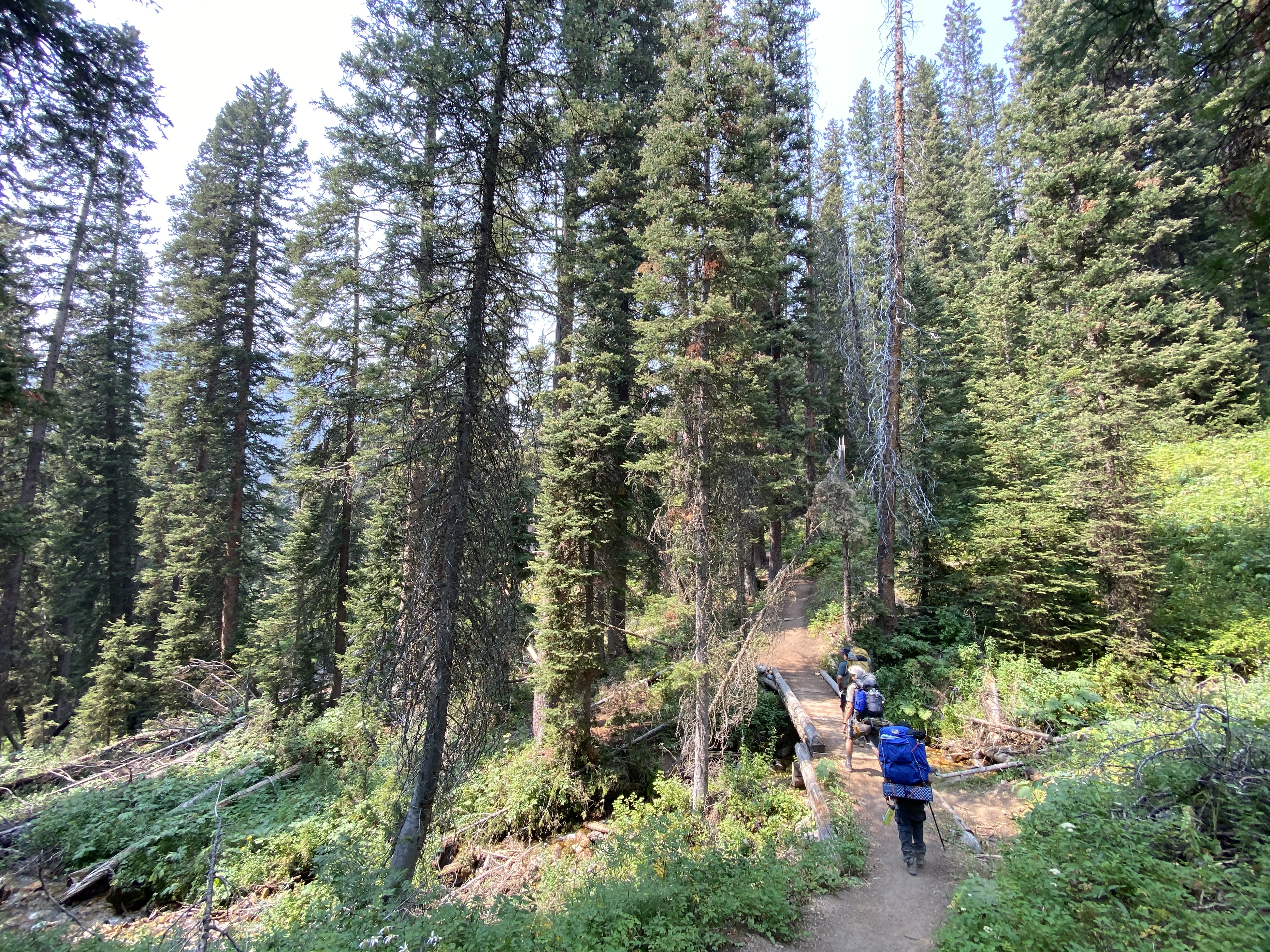
Day 1: Granite Canyon Trailhead to Death Canyon Shelf
After we picked up our permits and got all packed up, we called a taxi to take us to the Granite Canyon Trailhead. We thought it would be a good idea to leave our car at the end of the trail so we didn't have to worry about getting back to our car after a long trip. Getting to the trailhead was very straight forward and we hit the trail around 10:50am.
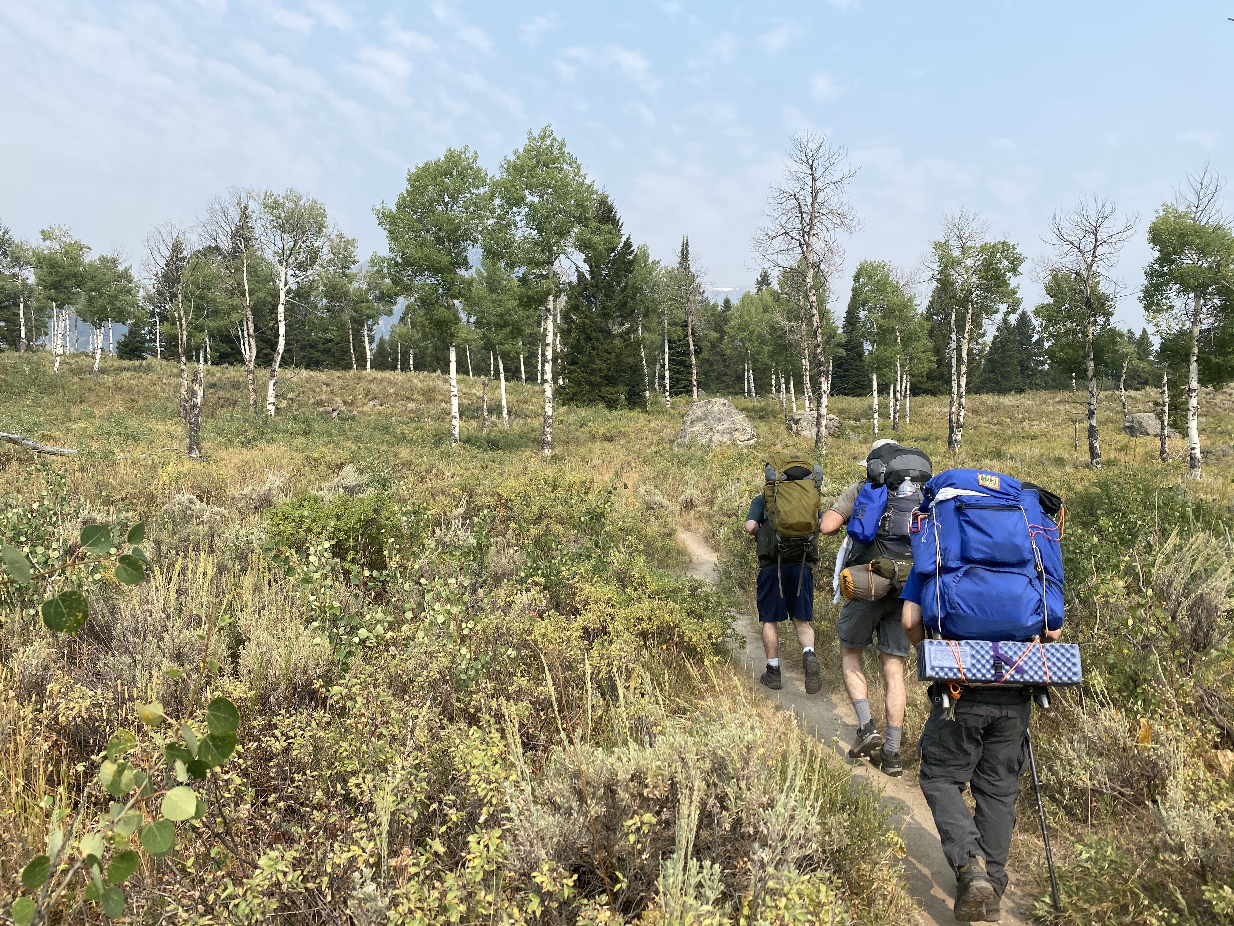
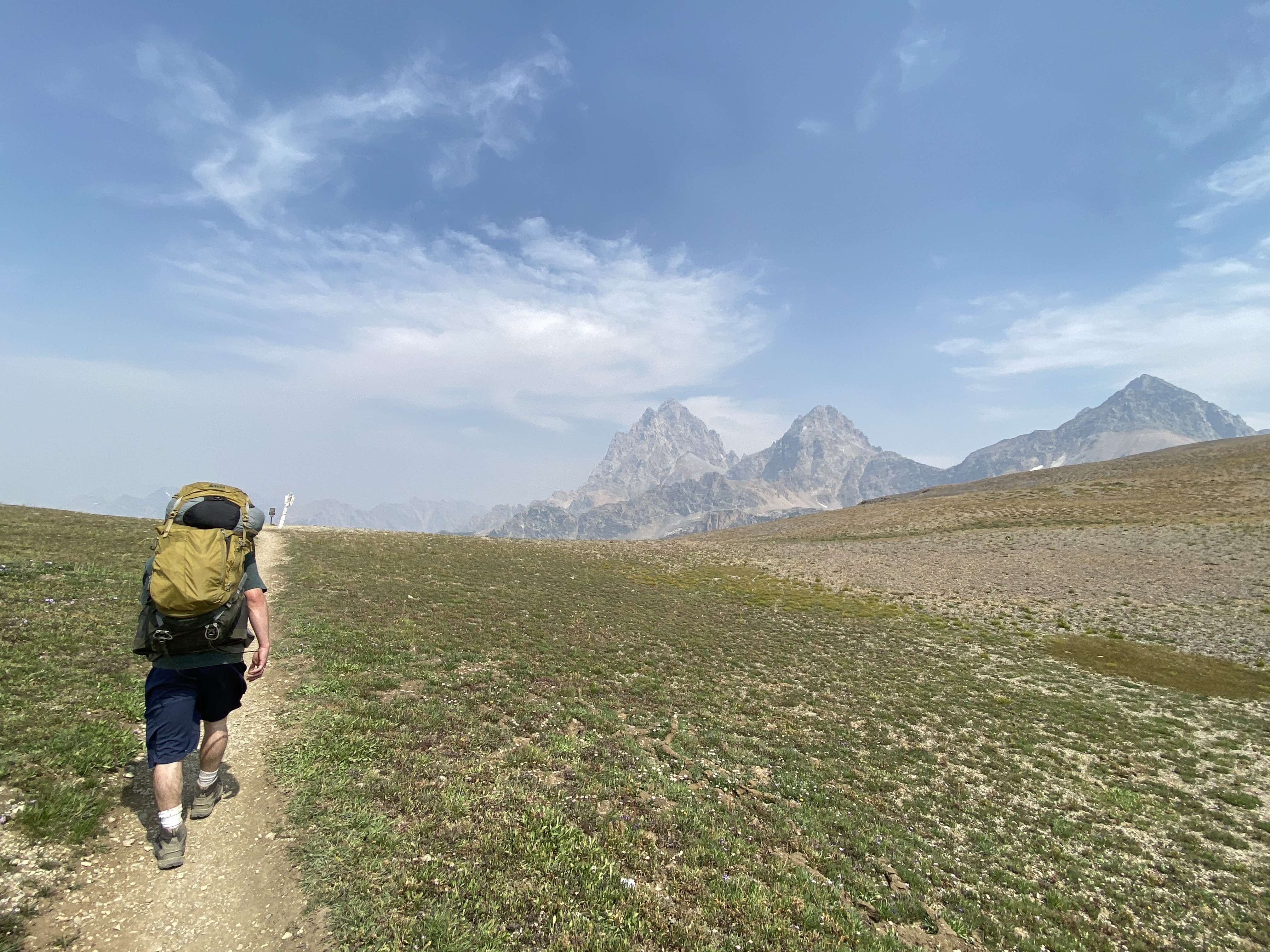
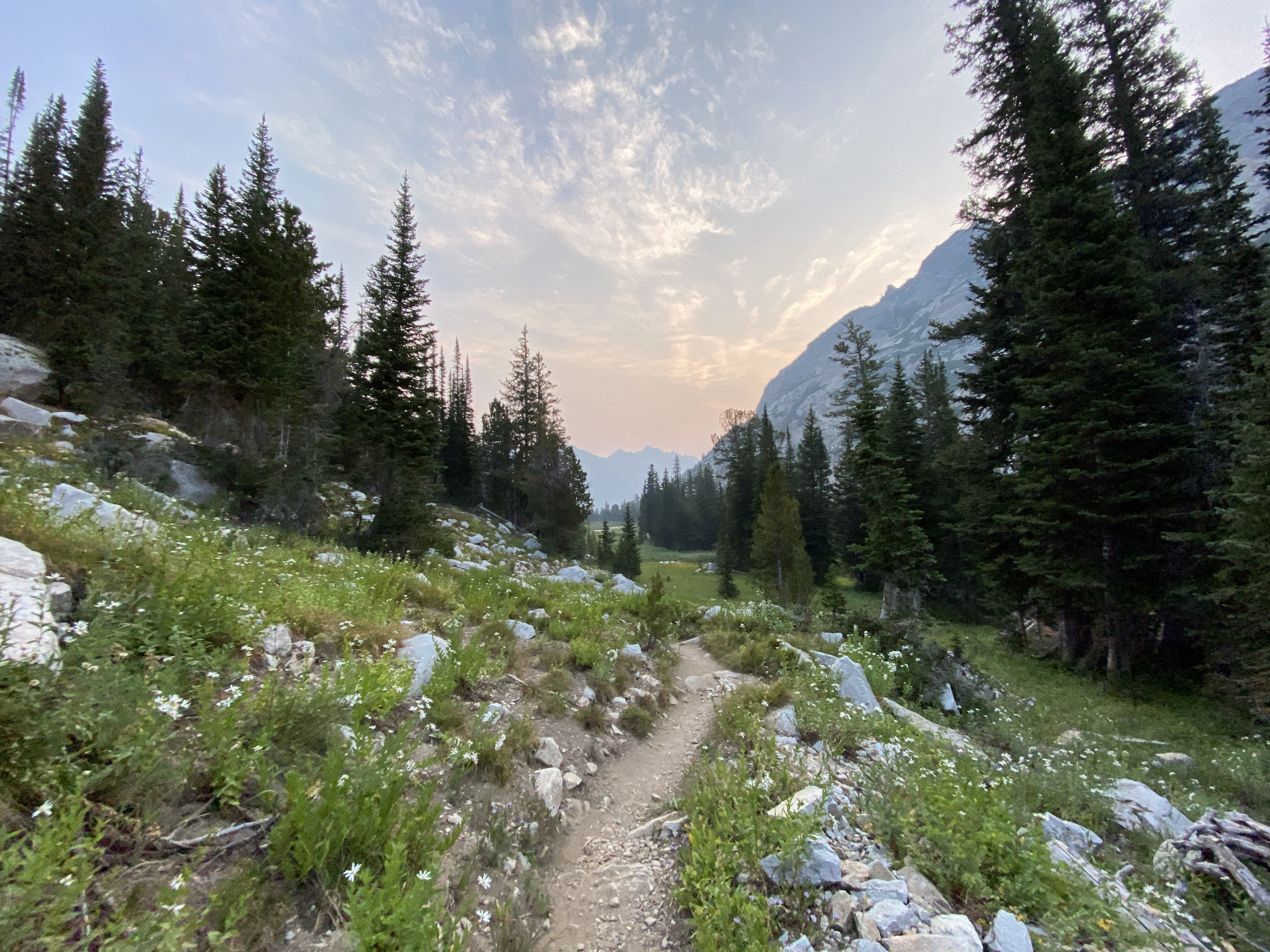
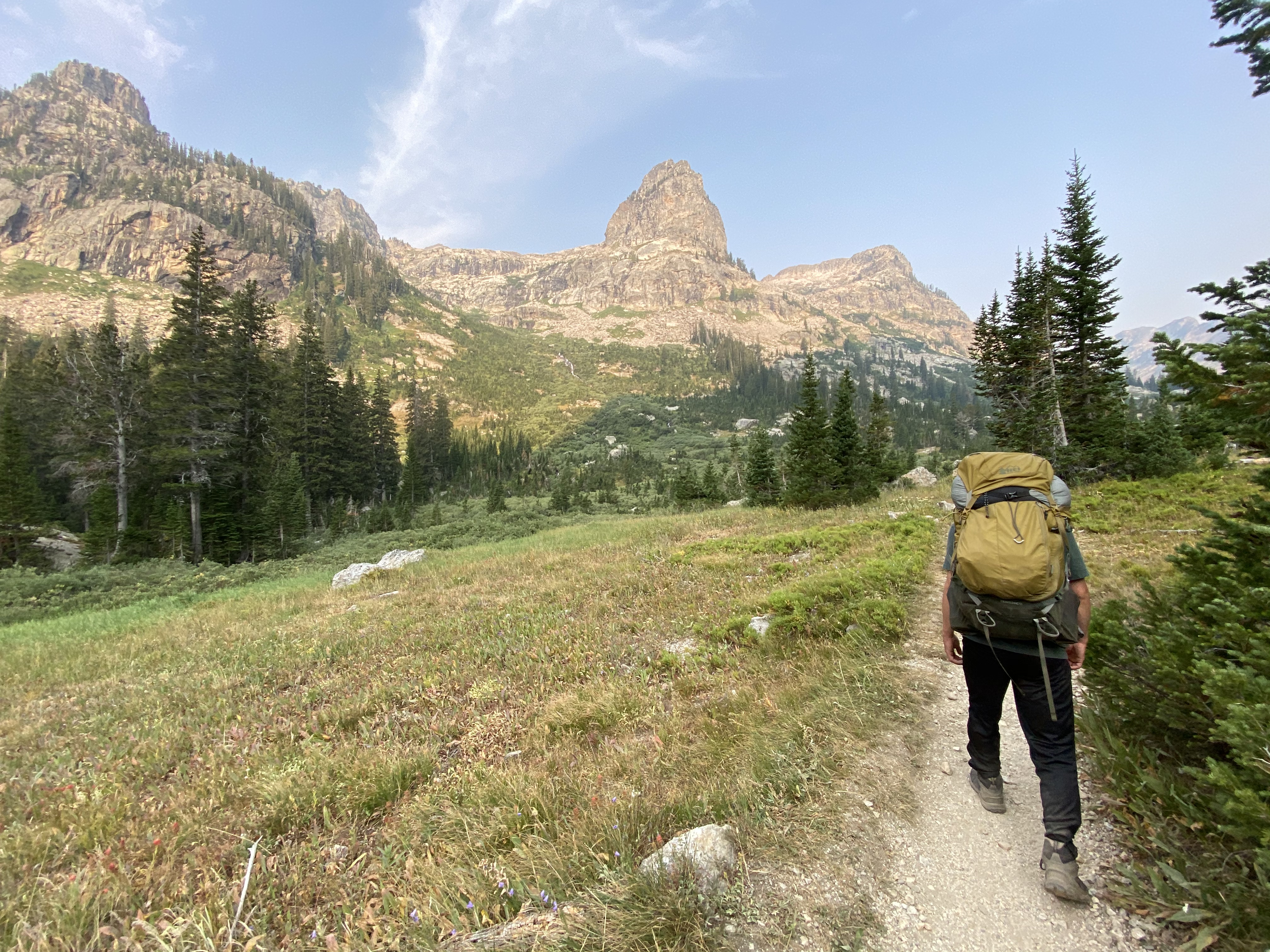
The first day was definitely the longest and biggest day in terms of elevation gain. I remember the trail starting out in a beautiful aspen forest. Lower down in most of this region, there are a lot of aspen trees. The trail is pretty straight forward, and it's not particularly interesting until you get to the junction with the Teton Crest Trail. Once you get higher up the the aspen trees disappear and you start to notice lodgepole pine trees.
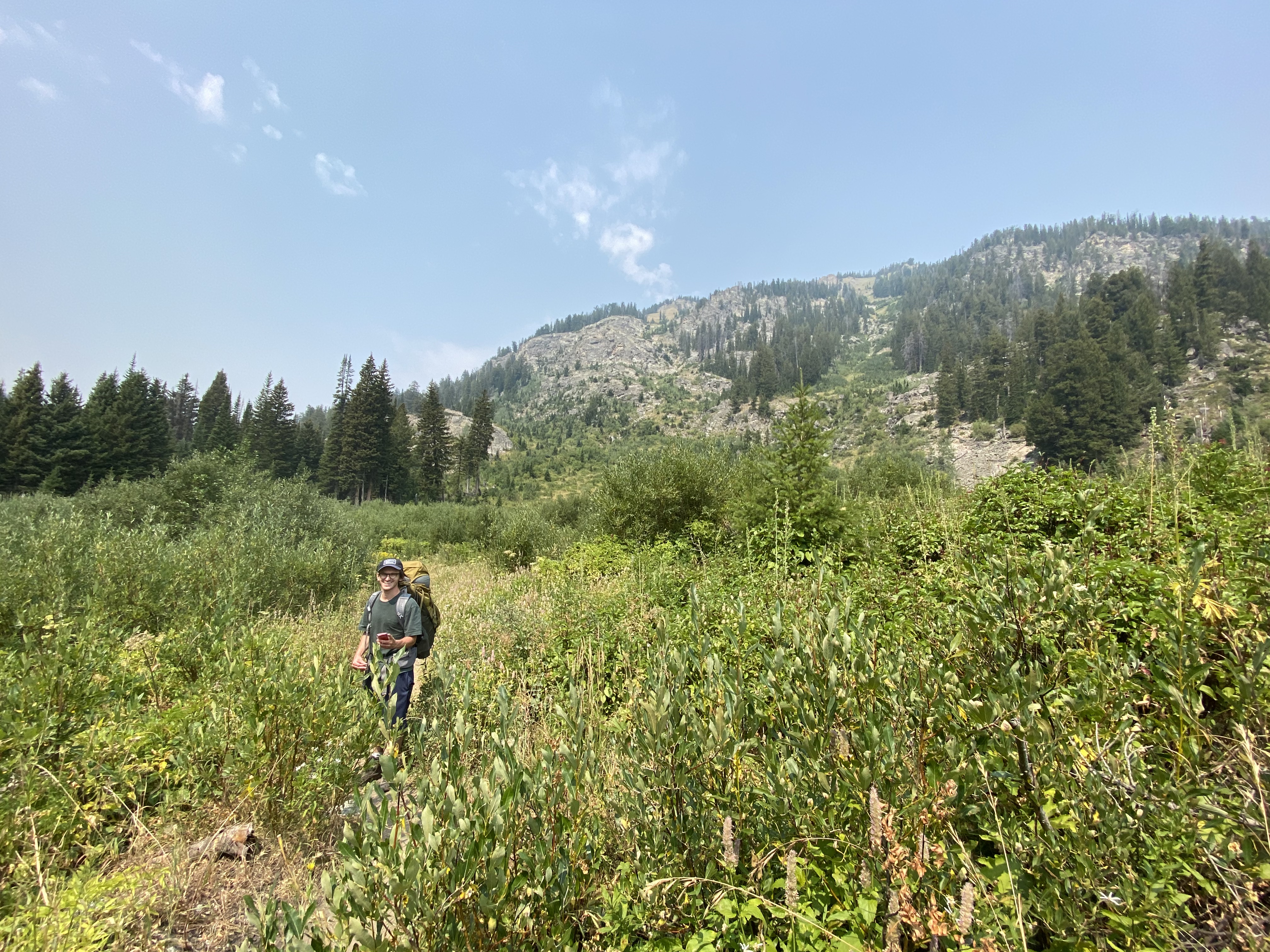
After the final ascent, roughly 9 miles and 3,000ft elevation, we made it to Marion Lake! There aren't any water sources until Marion Lake so, I would make sure you have enough water to get you there. We arrived at Marion Lake at around 3:30pm and decided to take a break and have a quick snack.
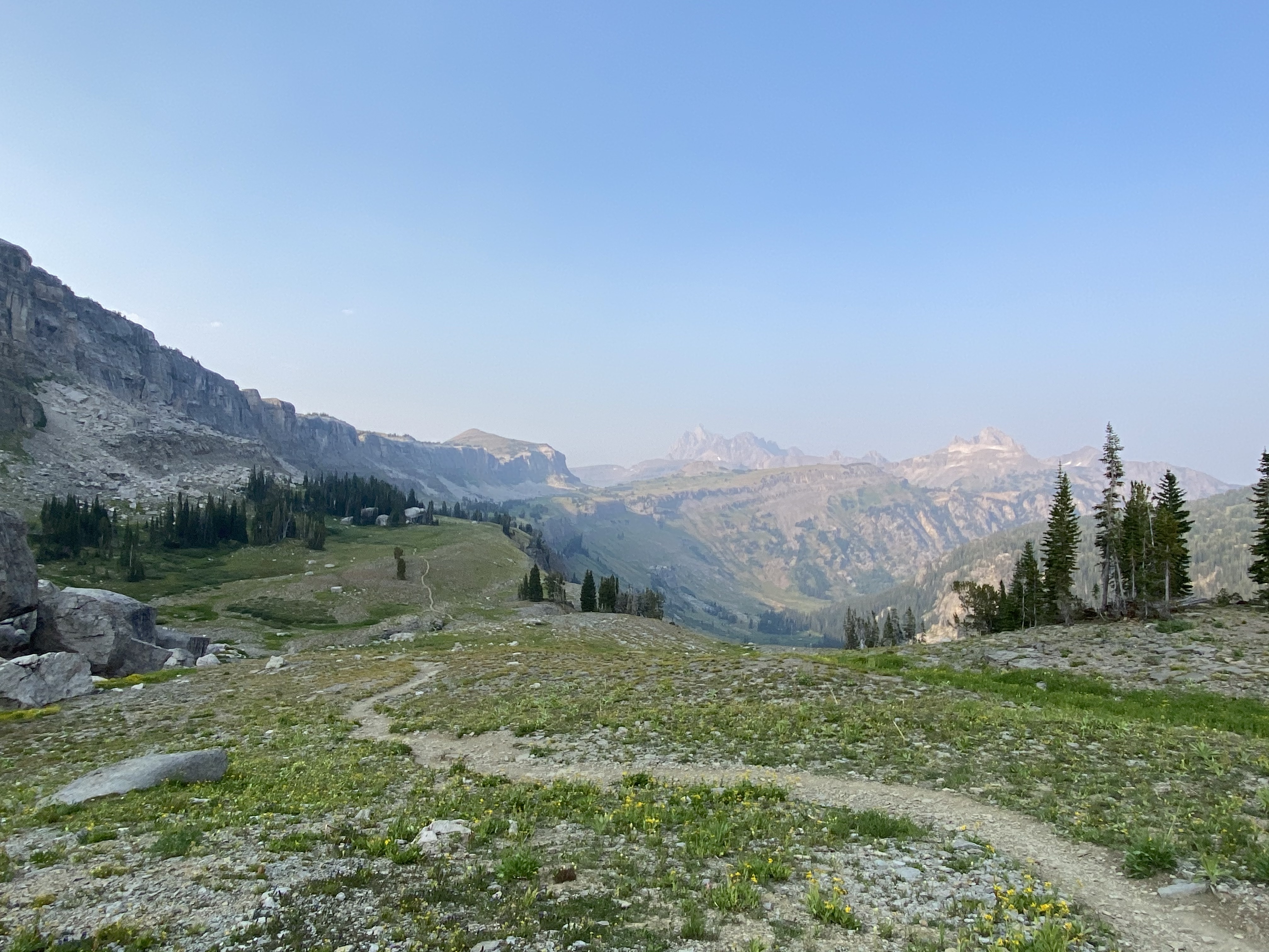
From here, it's pretty much smooth sailing. The trail leads up one more mini-ascent, crosses into the boundary of Jedediah Smith Wilderness which is right when you get to a vast plateau, and then to Death Canyon Shelf. It's another 4-ish miles and roughly 700-800ft elevation to Death Canyon Shelf.

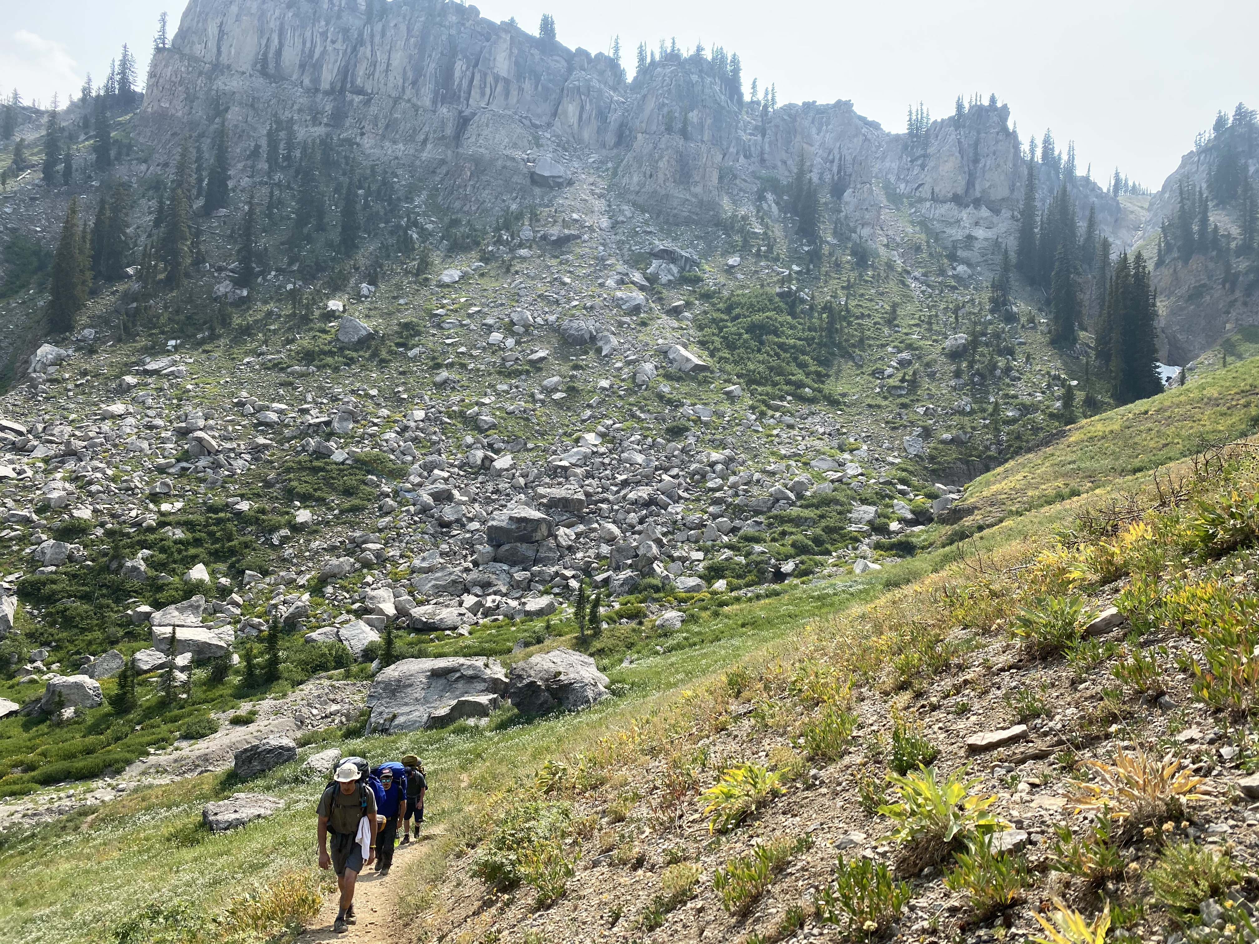
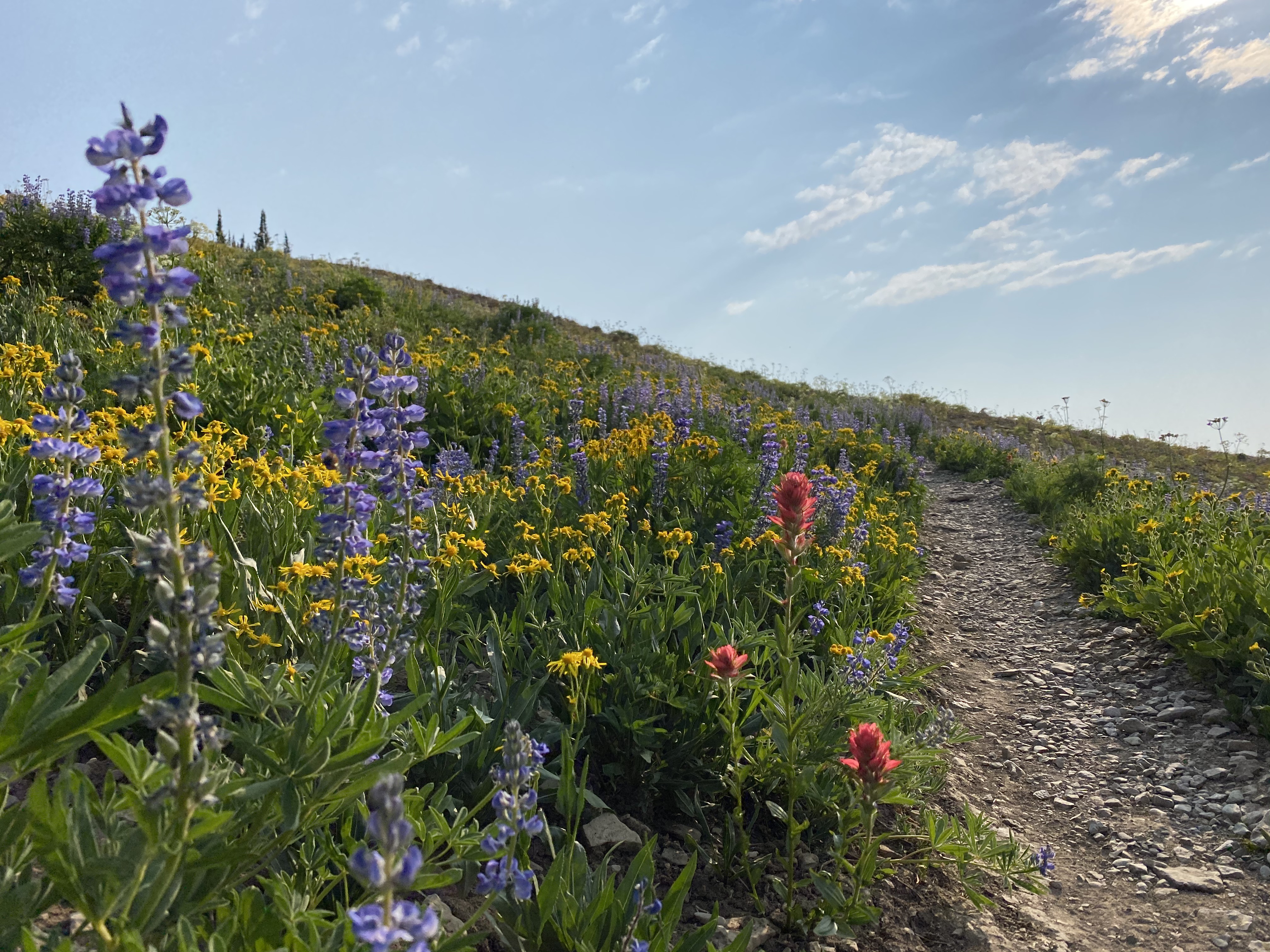
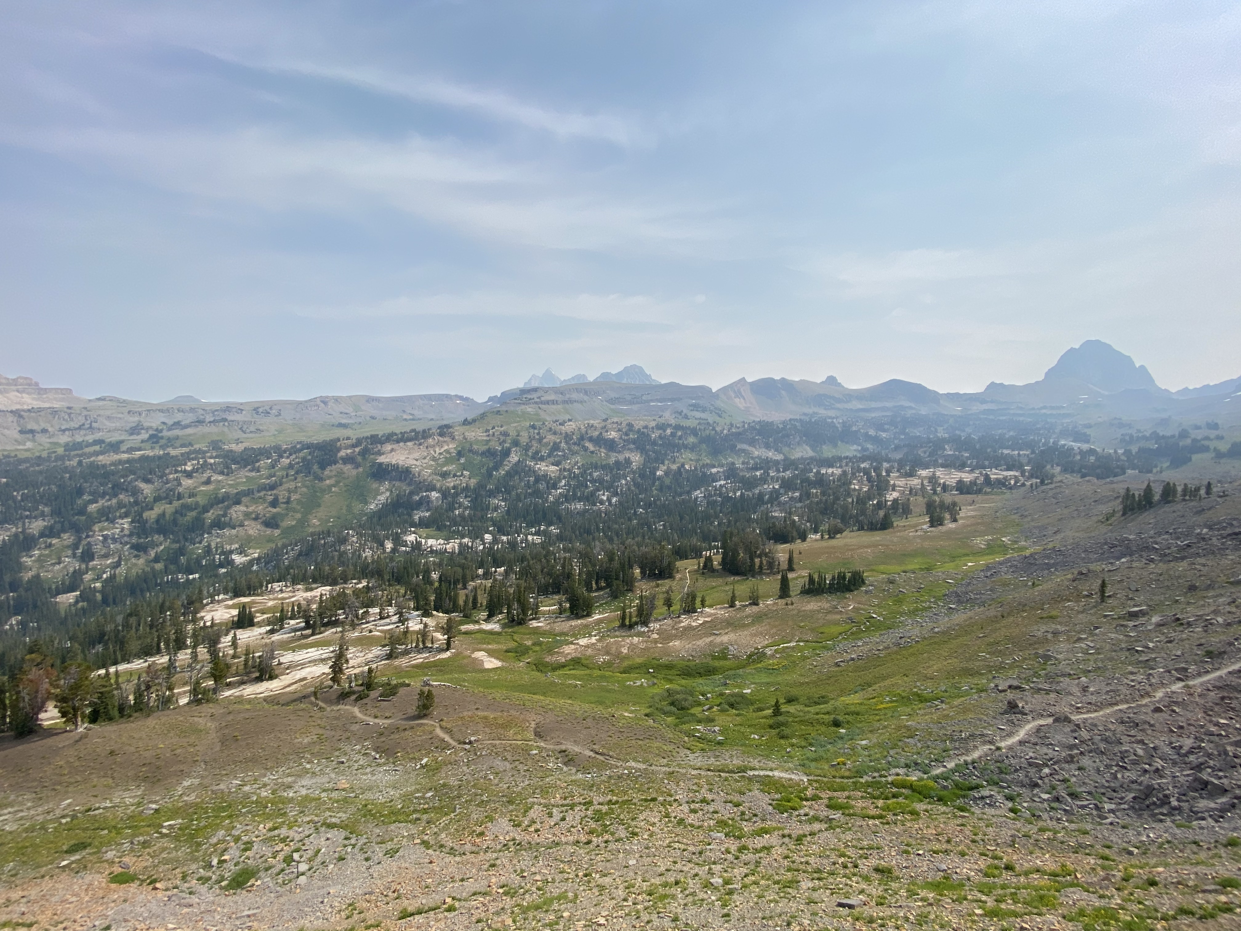
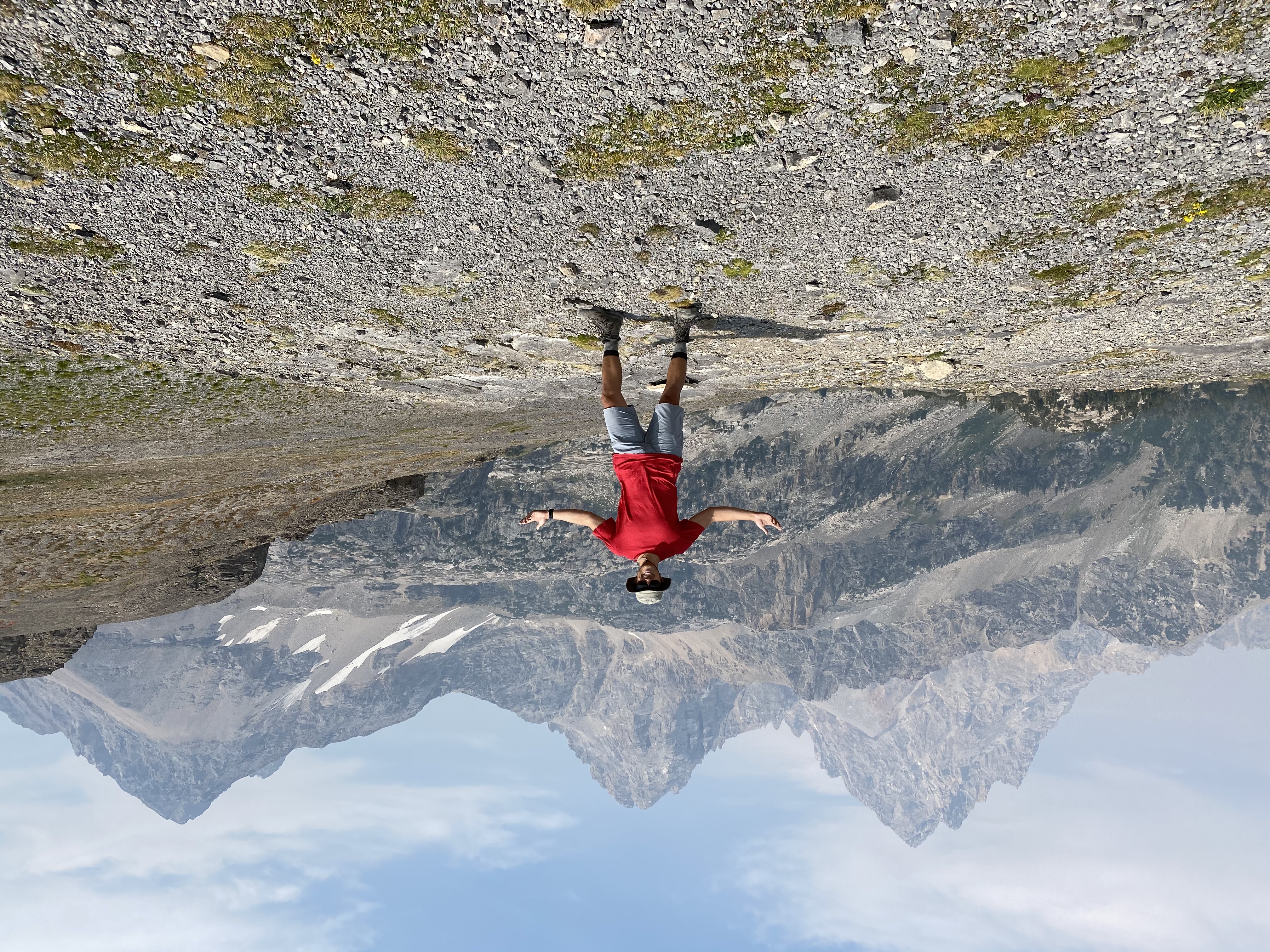
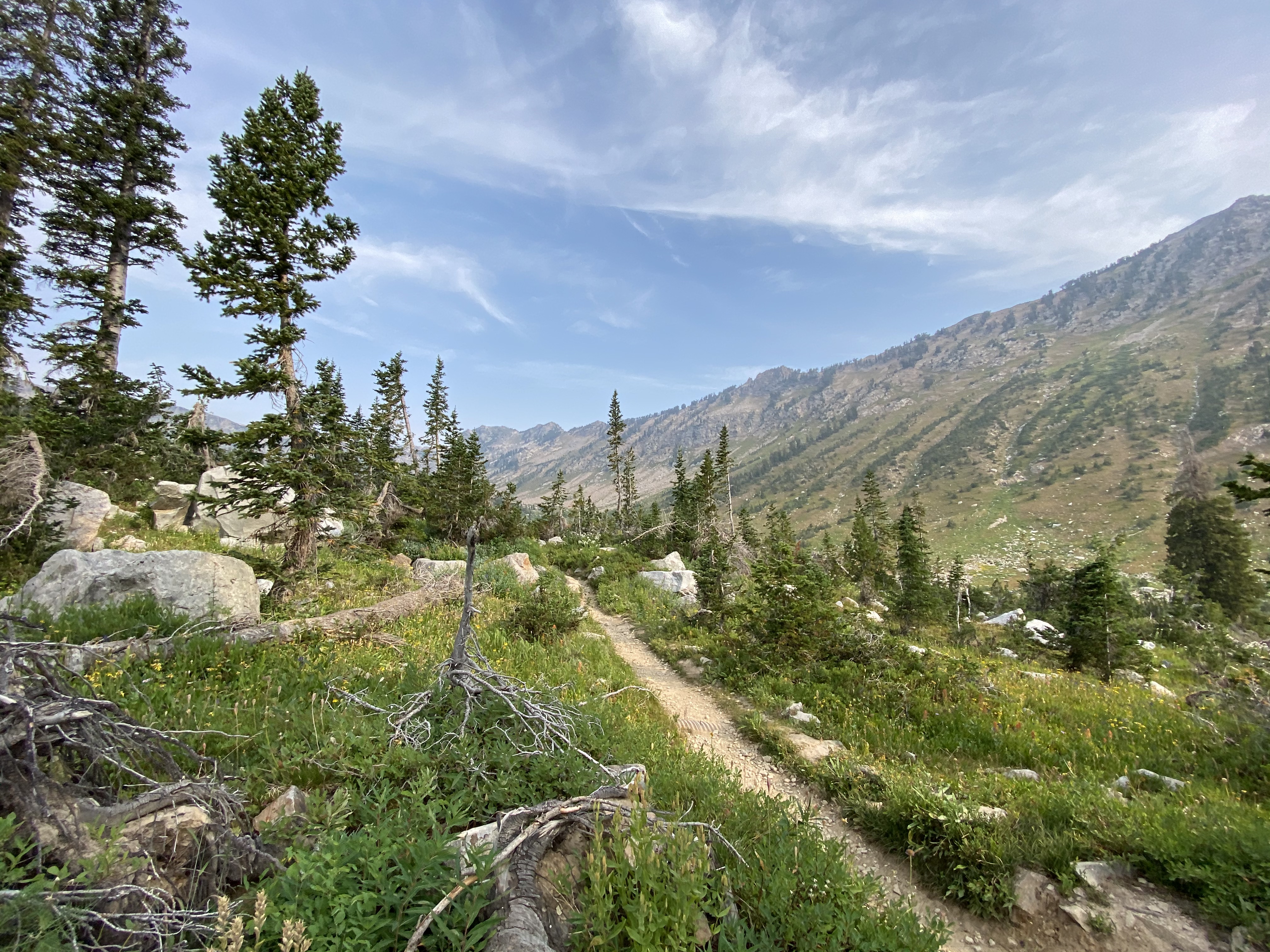
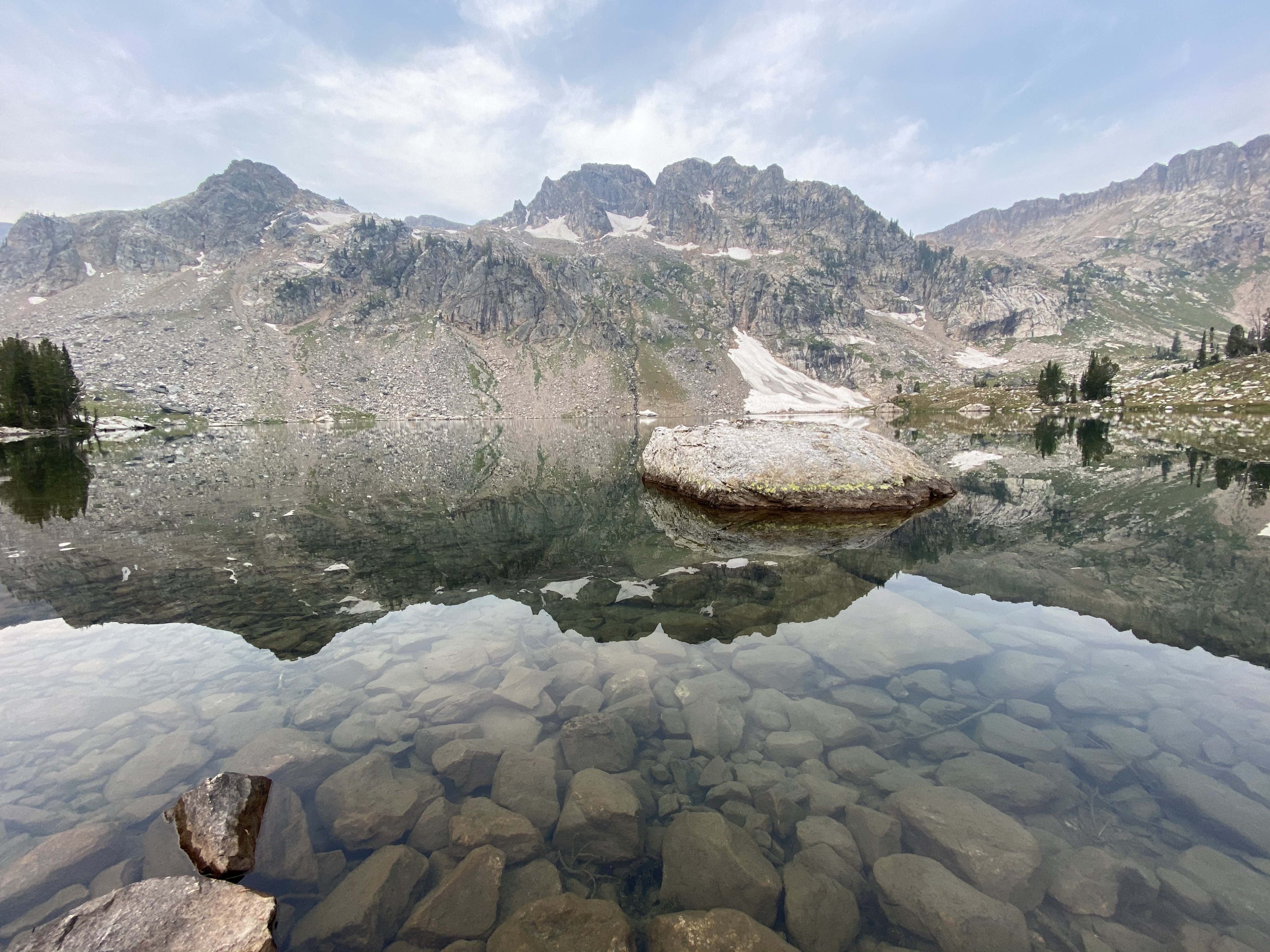
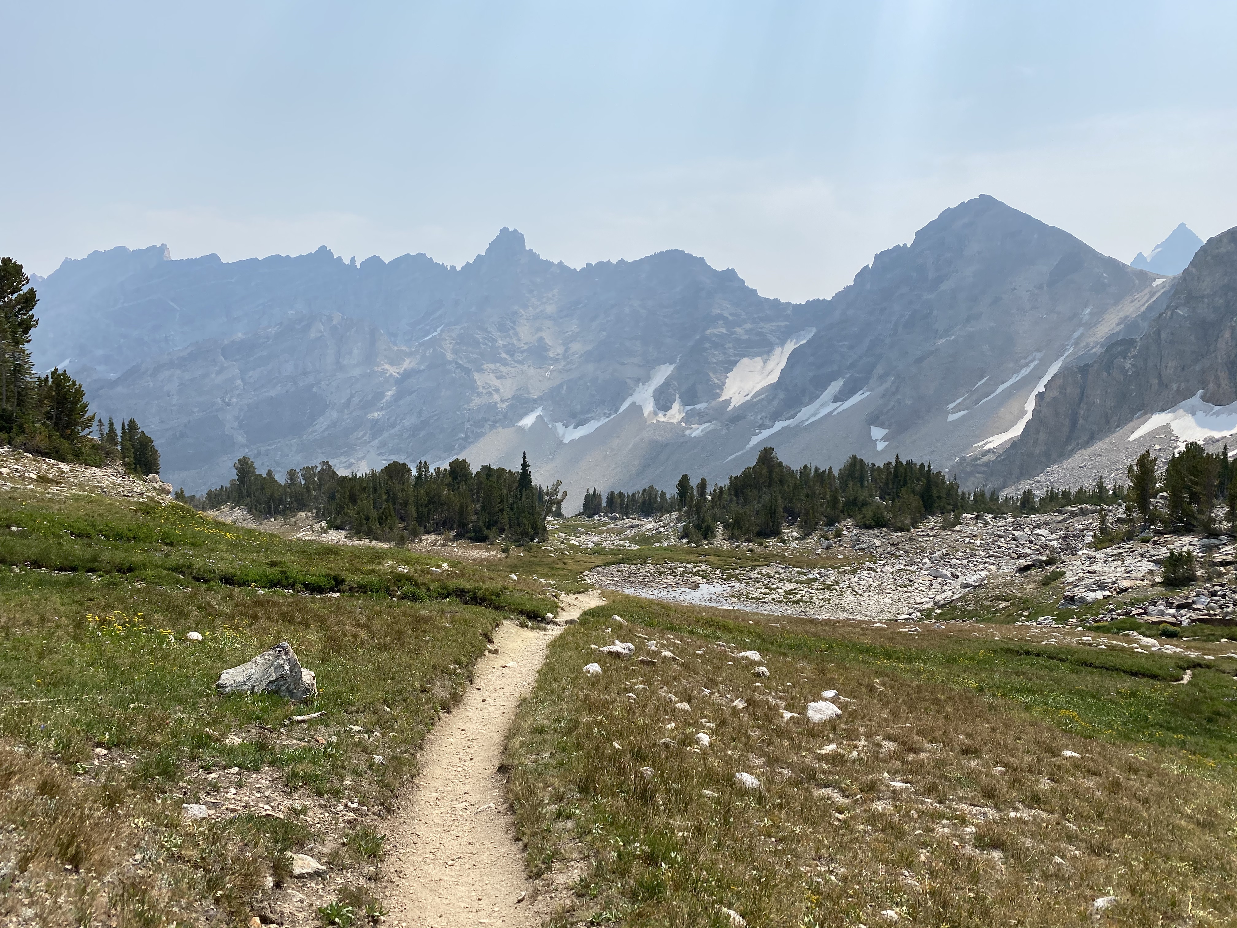
Once you get to Jedediah Smith Wilderness, the beauty of the Teton Crest Trail really starts! There were so many cool landscapes, wild flowers and mountain peaks. The plateau you end up on gives you such a cool vantage point to see far into the distance. The surrounding peaks look really interesting, and once you get to a point where you can see Death Canyon Shelf, it's really stunning. A very interested land structure.
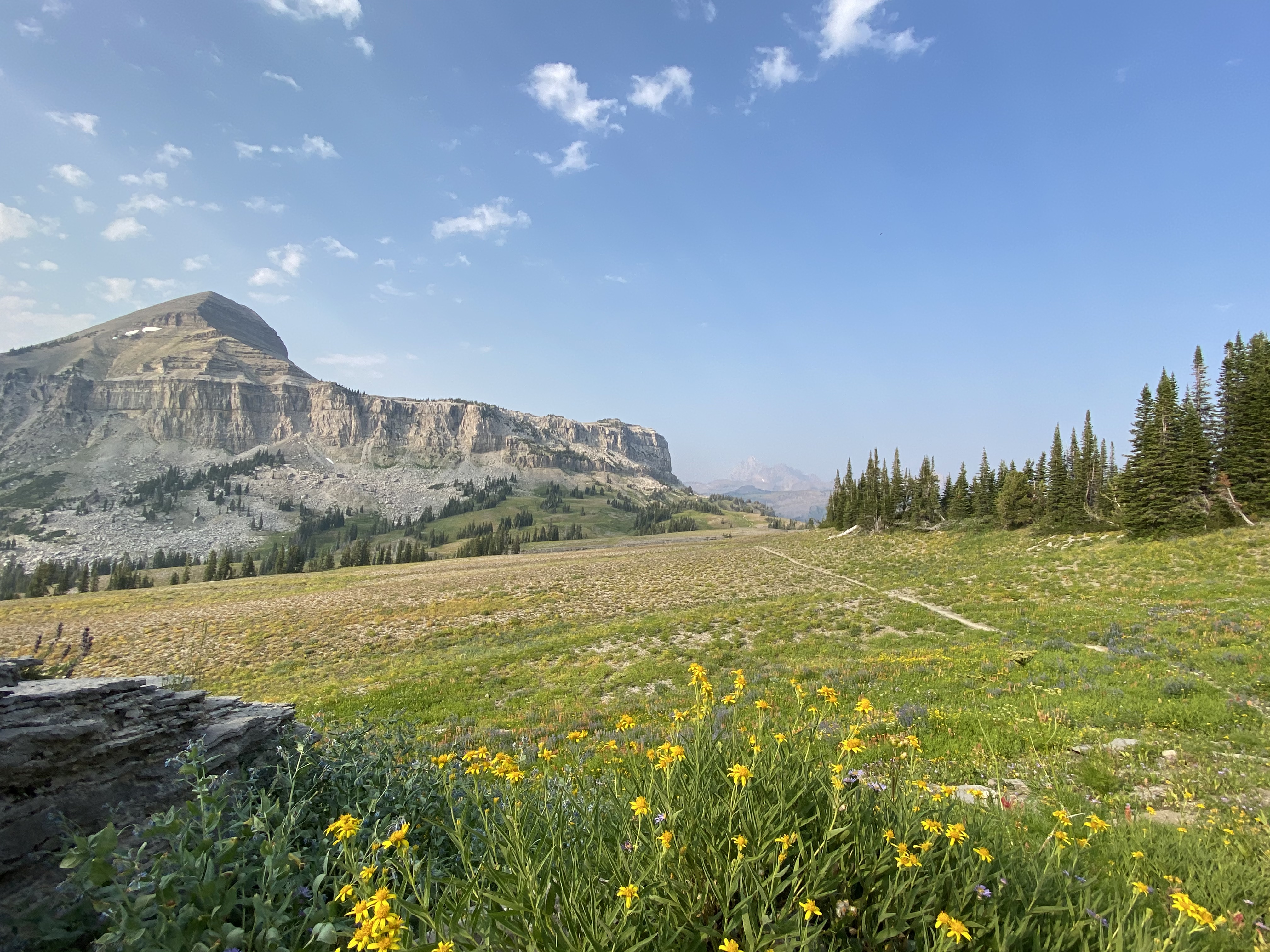
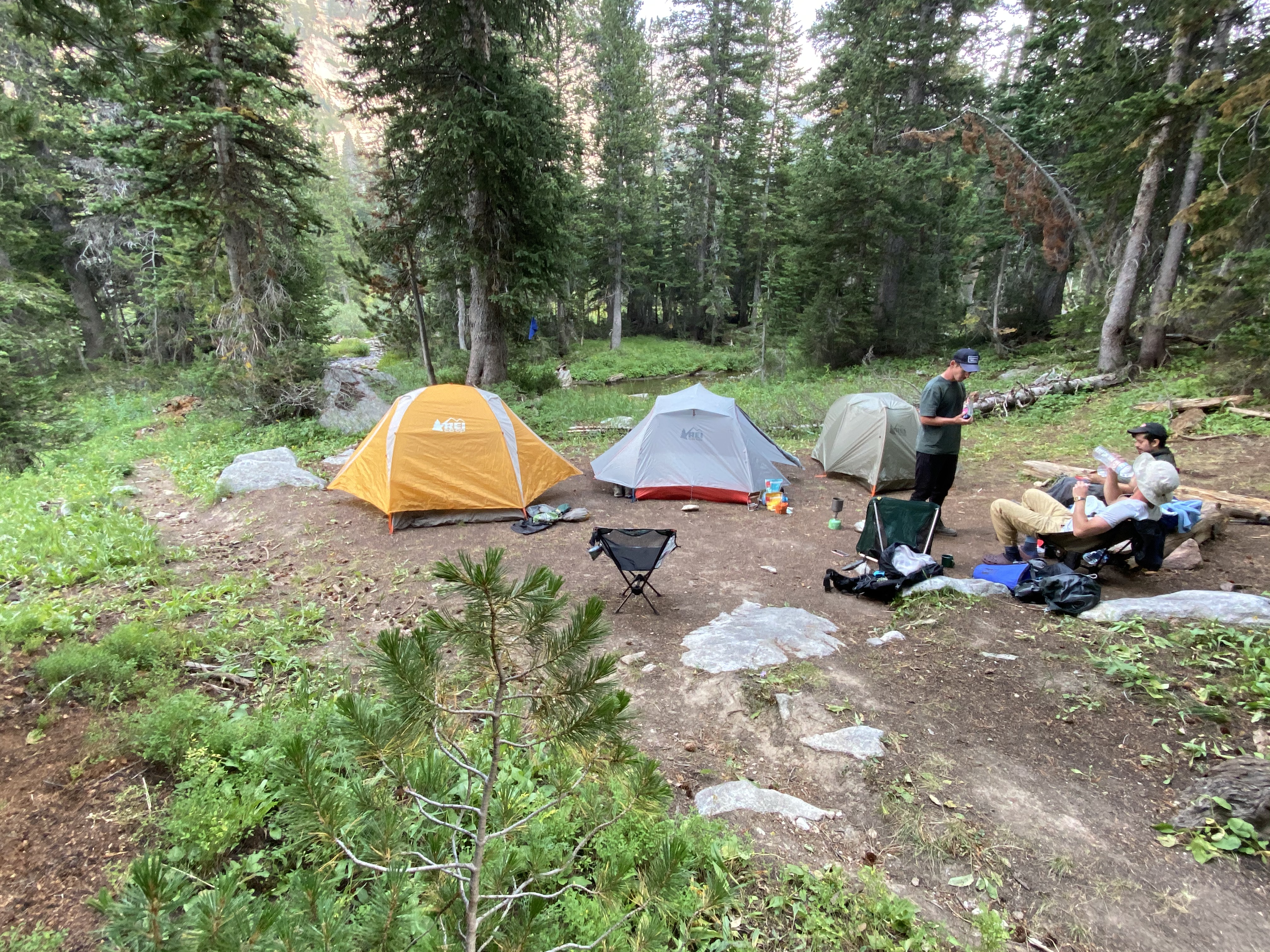
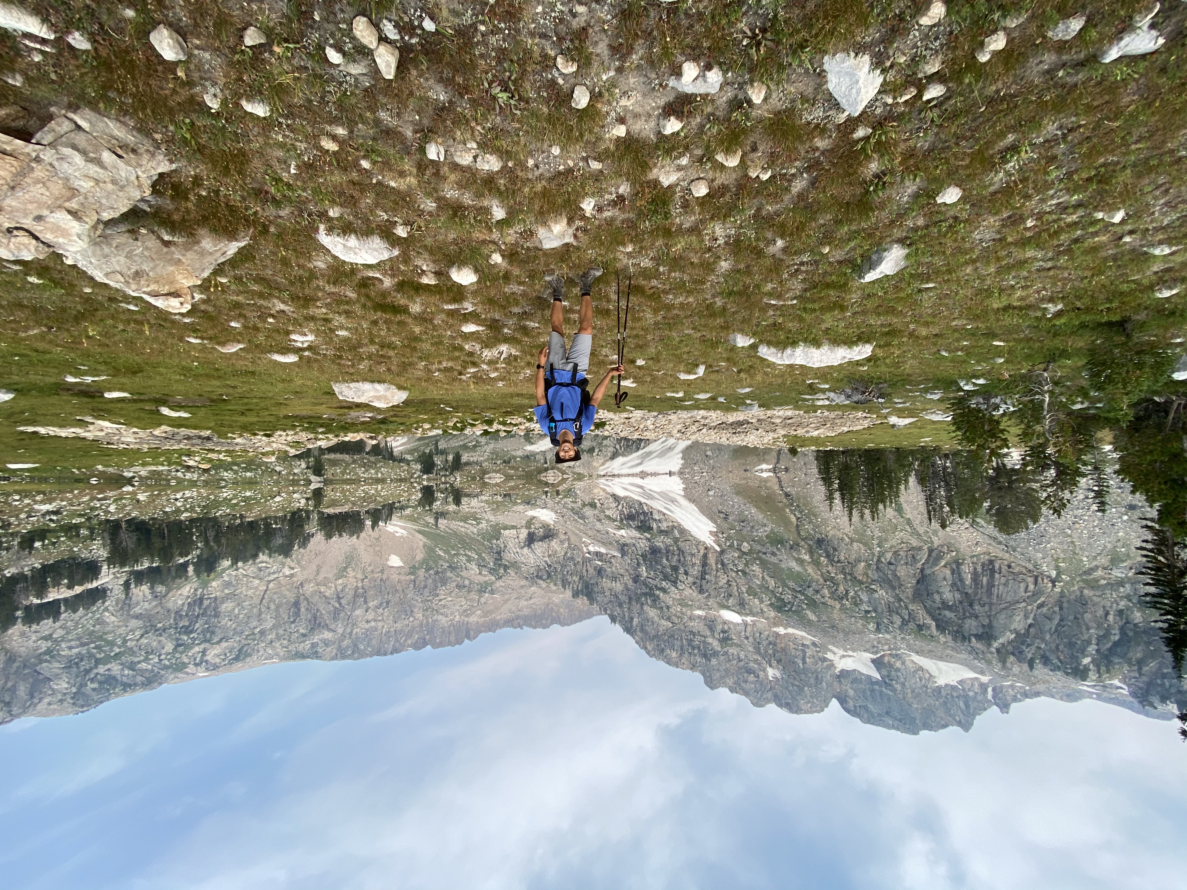
We found quite a few nice places to camp on Death Canyon Shelf. The one we chose was right next to a huge boulder, and was close to a nice fresh water stream that we stumble upon. We arrived at this campsite at around 6:45pm. It was a solid 8 hour day. We were pretty tired, so we had some dinner, enjoyed the views, and went to bed.
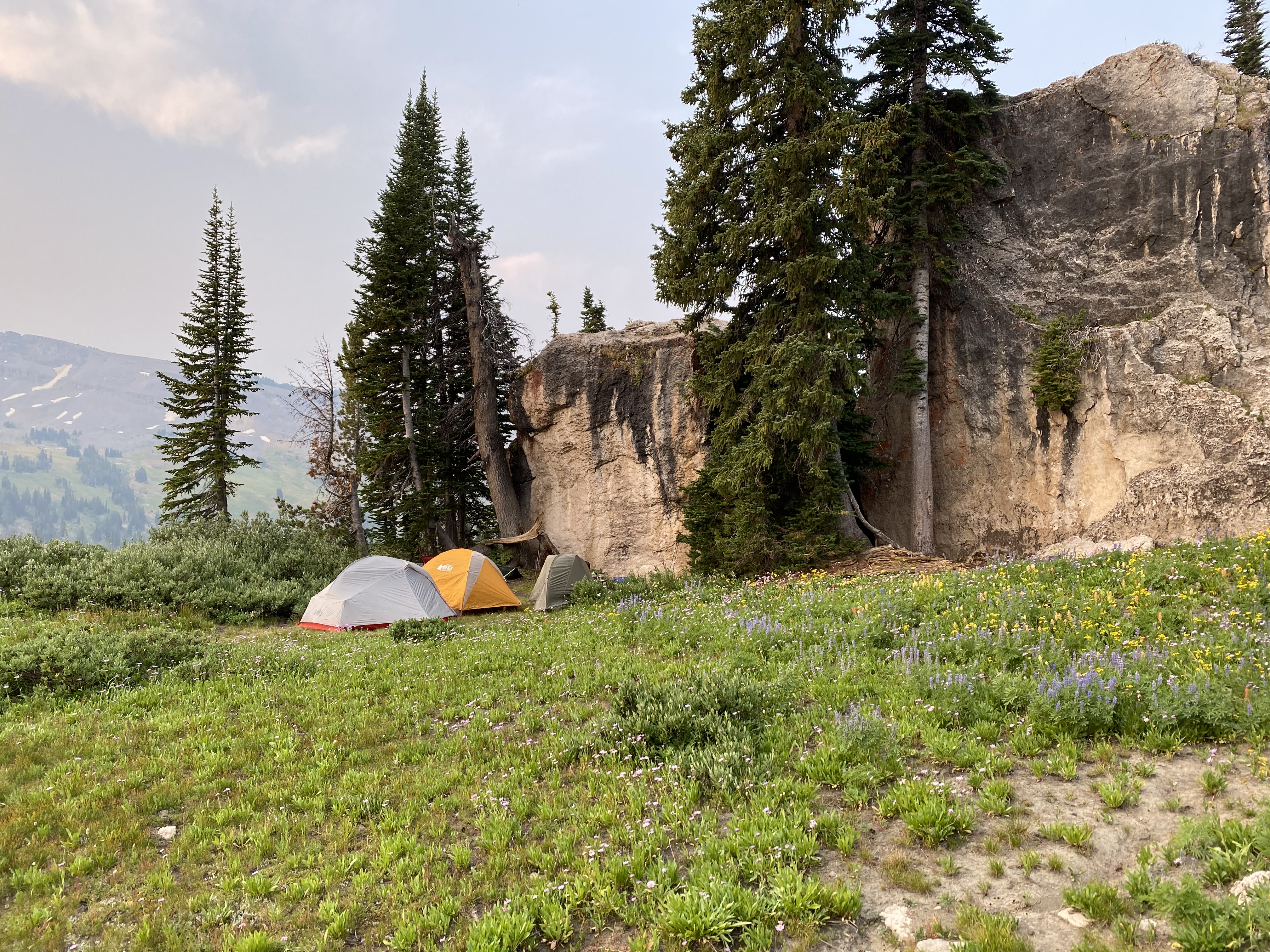
I woke up in the middle of the night to some strange noises. It sounded like something tugging at our backpacks. It turns out it was a pika chewing at the straps of mine and Ari's backpacks. It must have been attracted to the salt left over from our sweat. Don't be afraid to get out from your tent and scare those pesky pika away!
Day 2: Death Canyon Shelf to South Fork Cascade Canyon
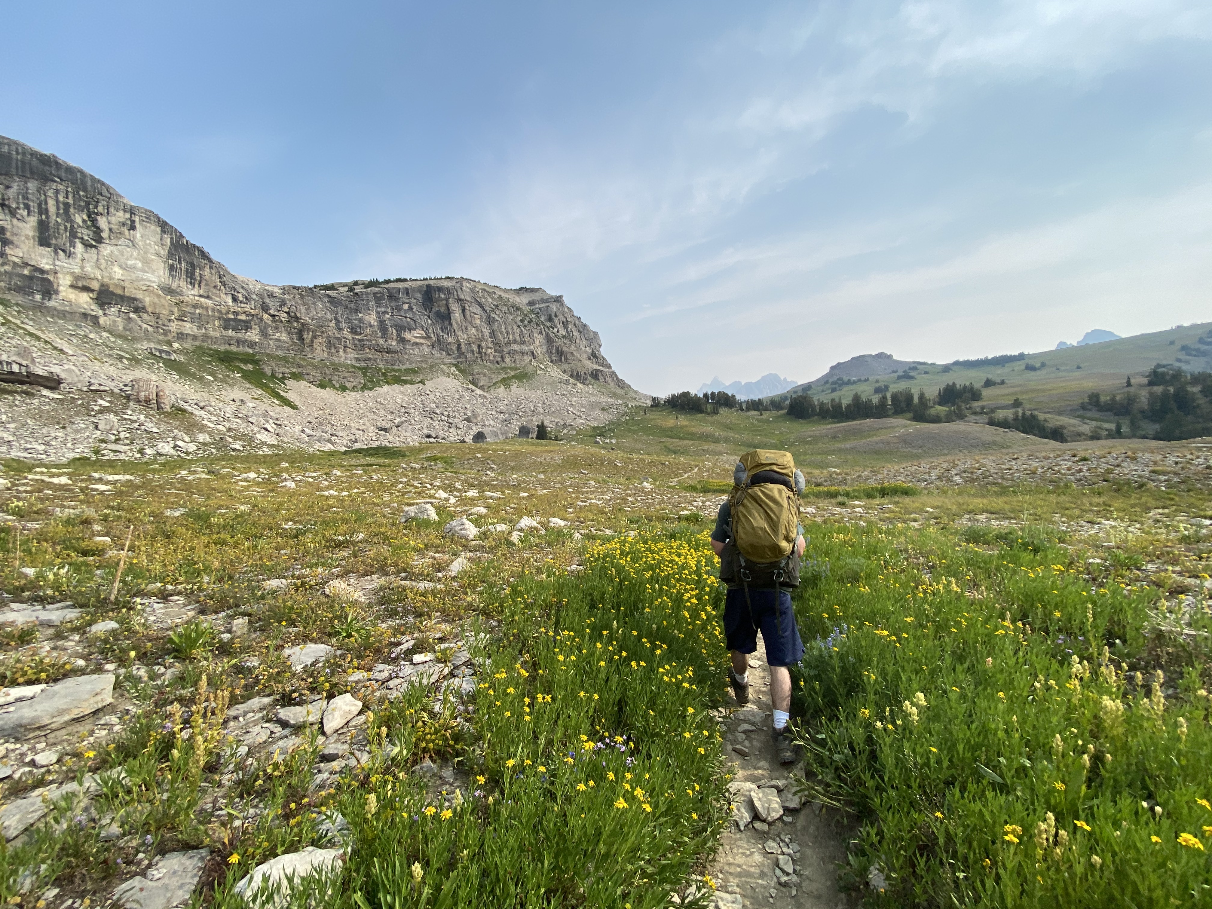
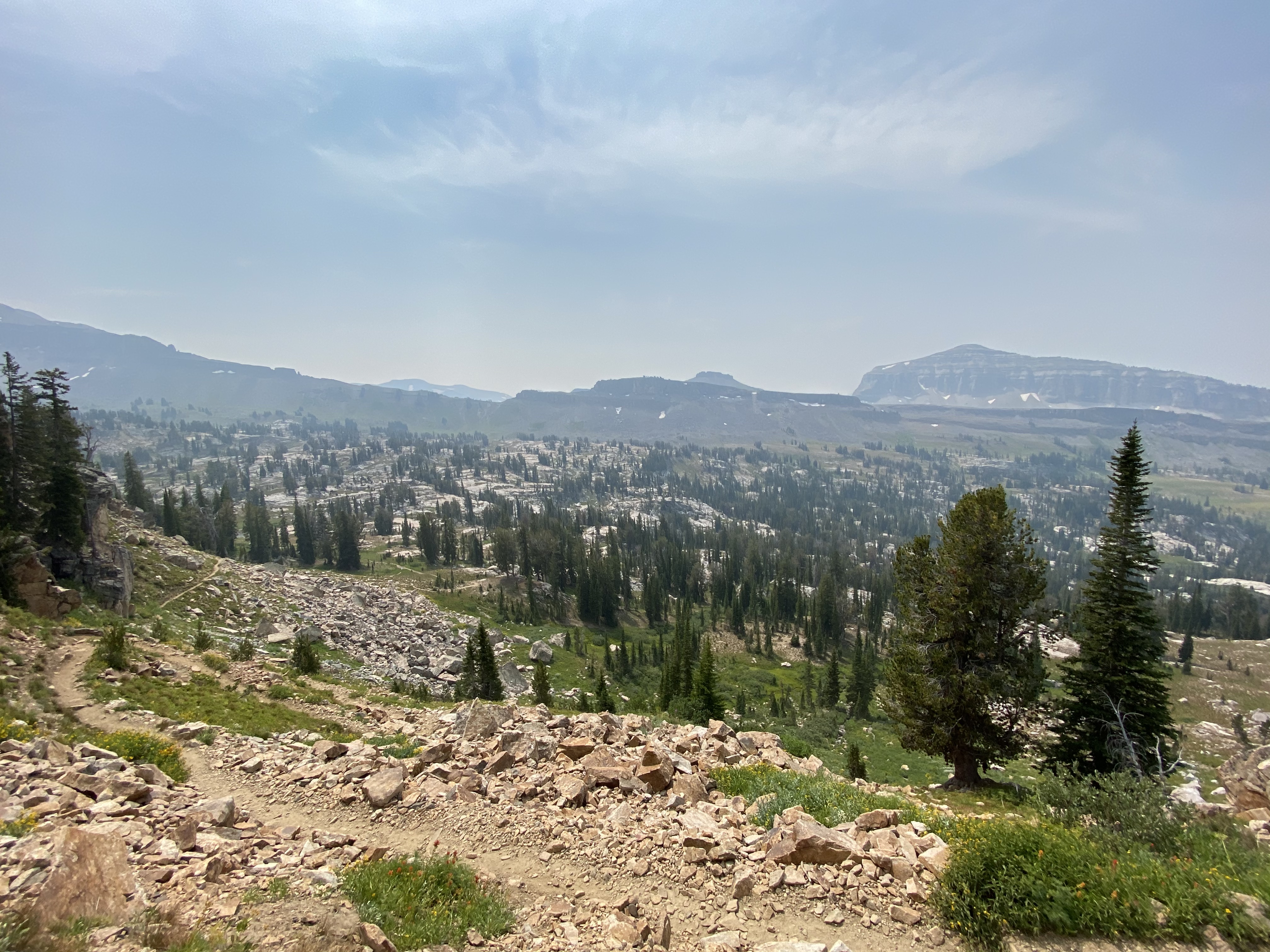
Day 2! Woohoo! The trail continues through Death Canyon Shelf and then leads down into Alaska Basin. The terrain in this area was quite interesting. It's filled with a bunch of little lakes and you feel quite remote.
We packed up and hit the train a bit late. I honestly don't quite remember when we left camp but, it must have been around 9:30-10:00am.
Once we got to the pass just before Alaska Basin, we took a little break, had a snack and checked the map.
By the time we got to Basin Lakes it was around 12:30pm. The hiking in this area was pretty easy. The basin is quite flat but, from here the trail starts to ascend towards Hurricane Pass. It's about 3 miles and 500ft of elevation from the bottom of the basin to Hurricane Pass.
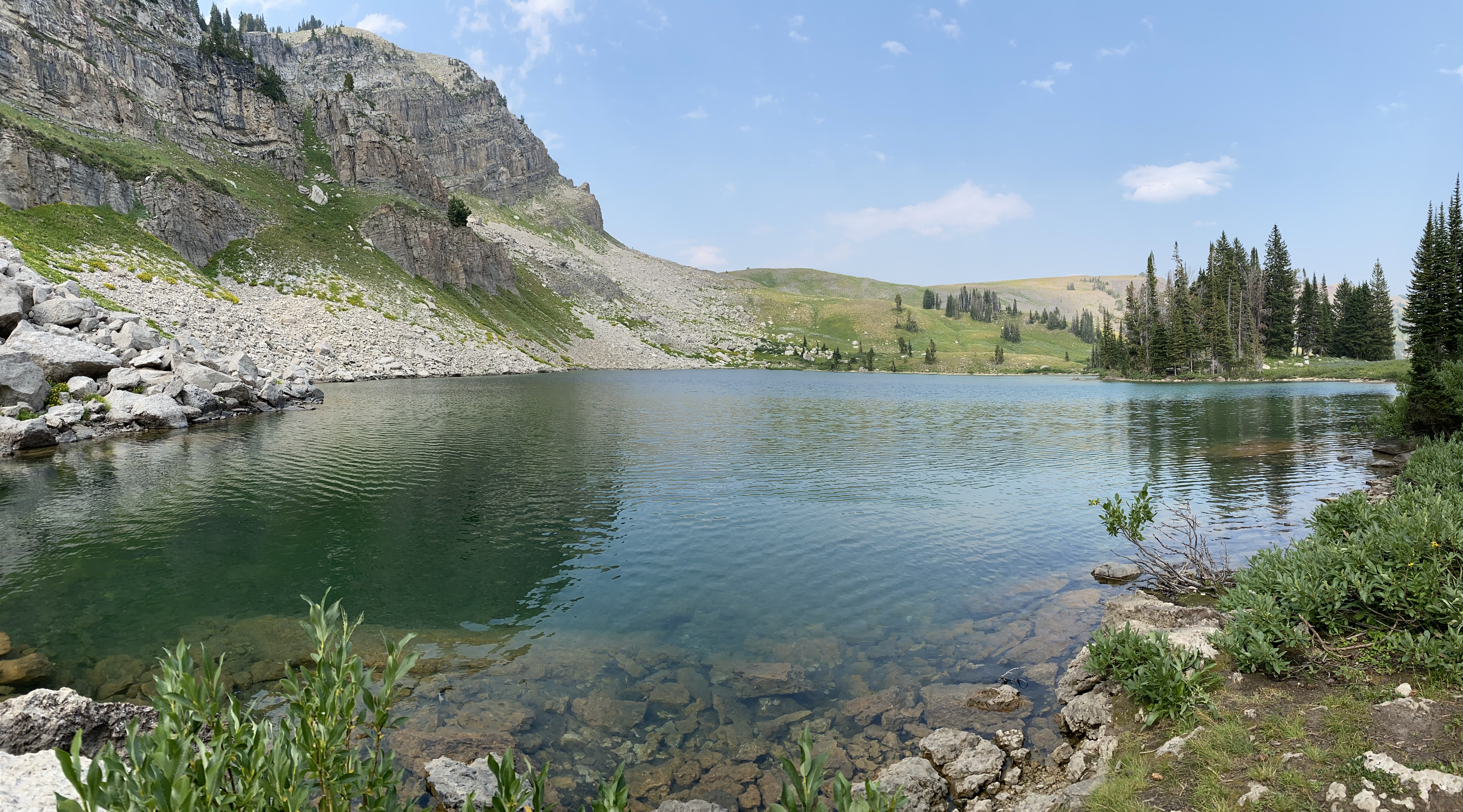
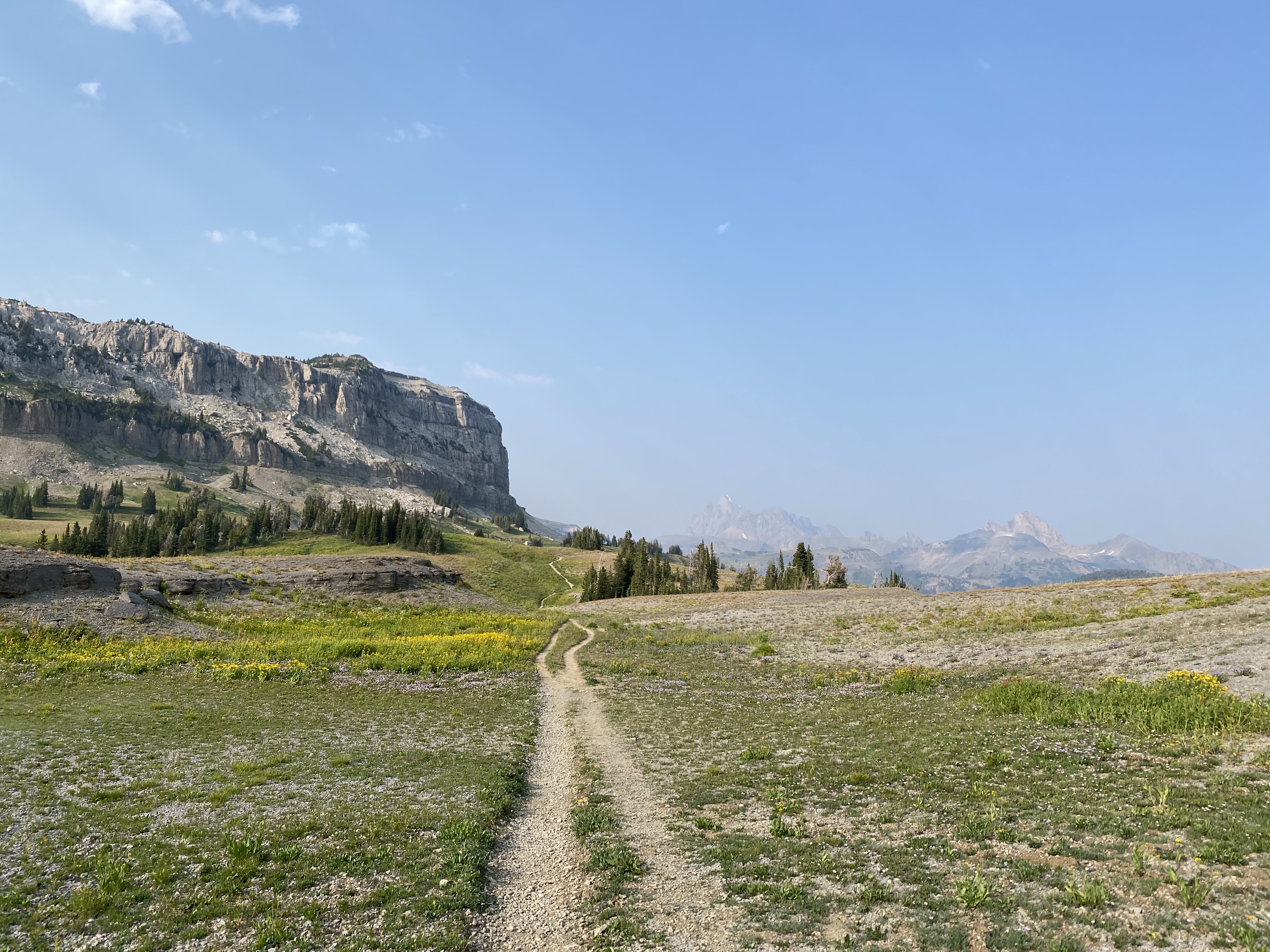
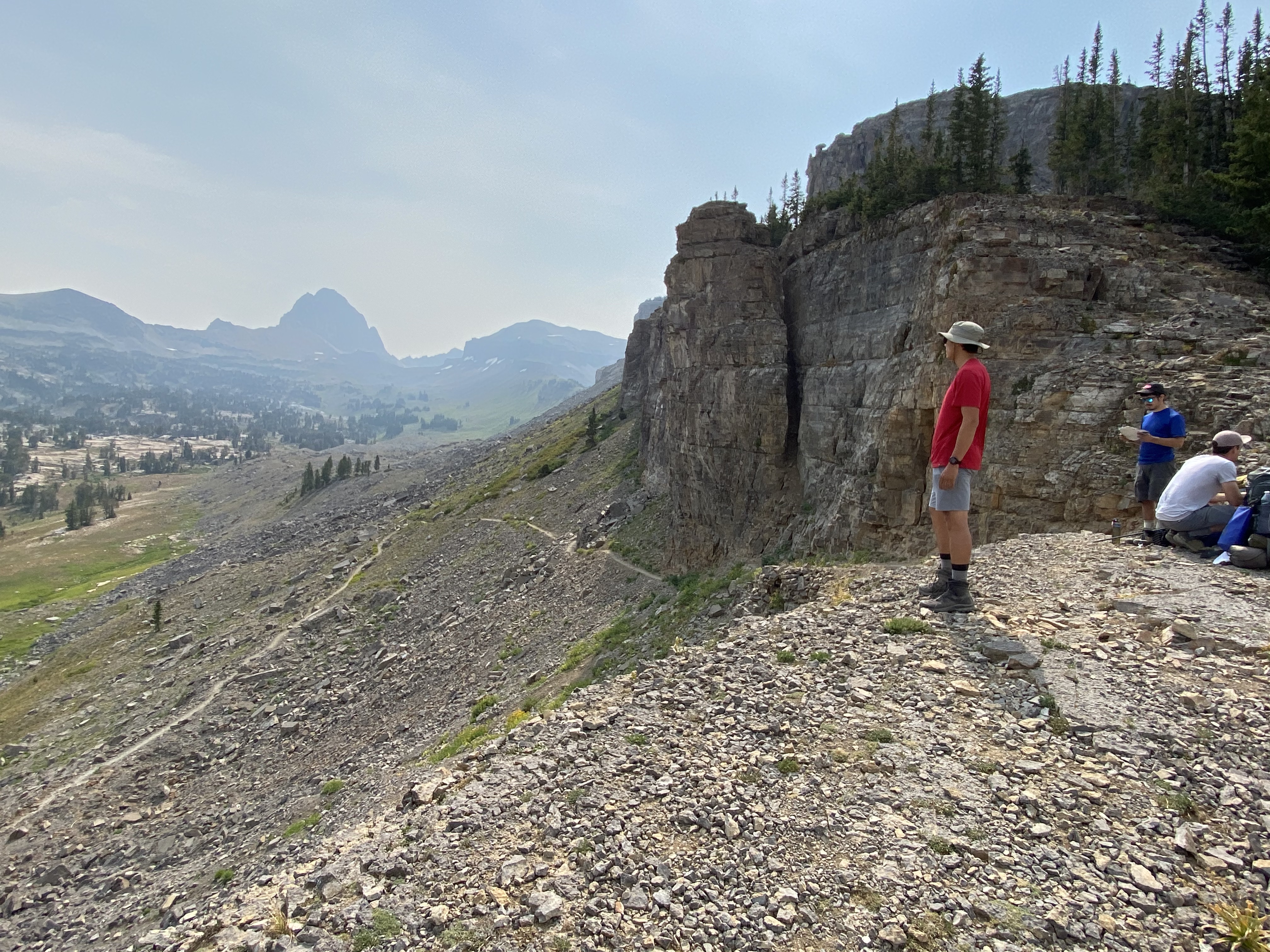
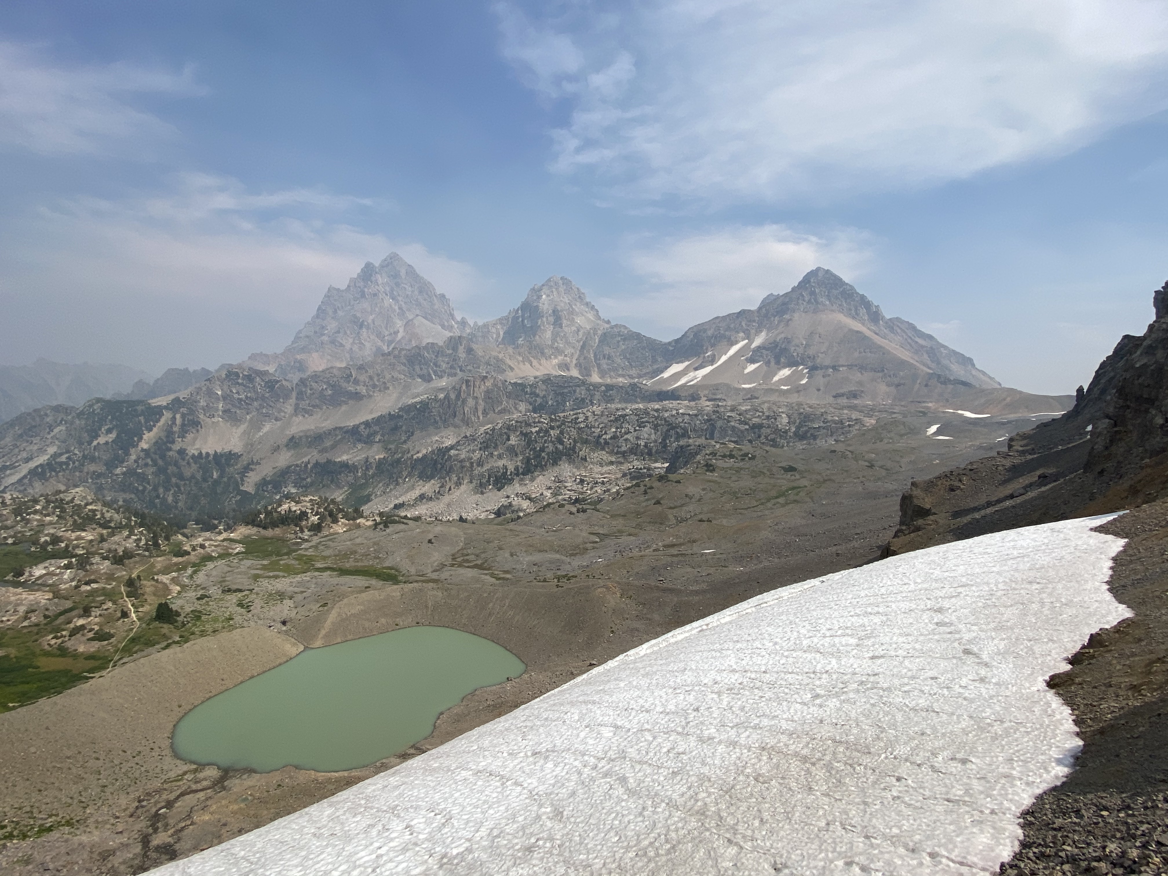
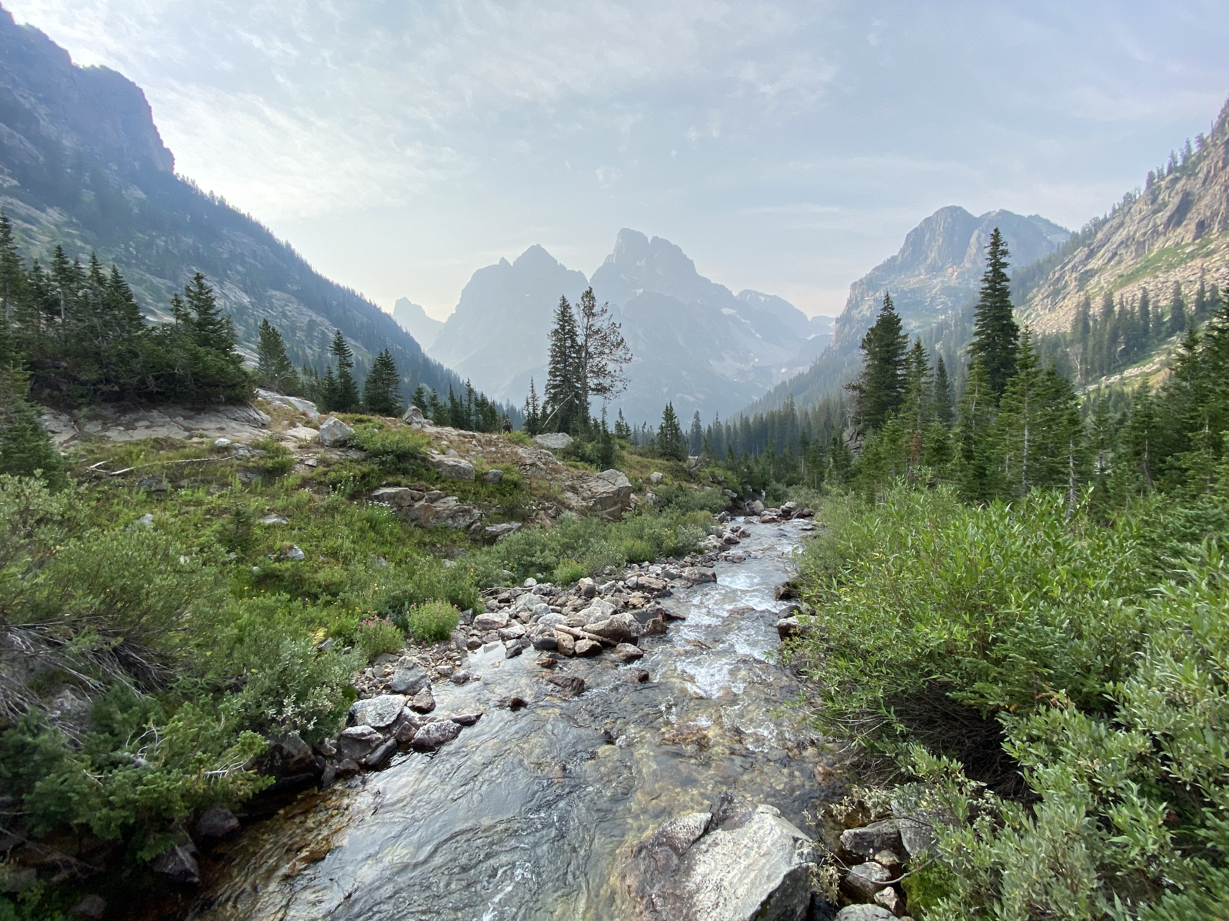
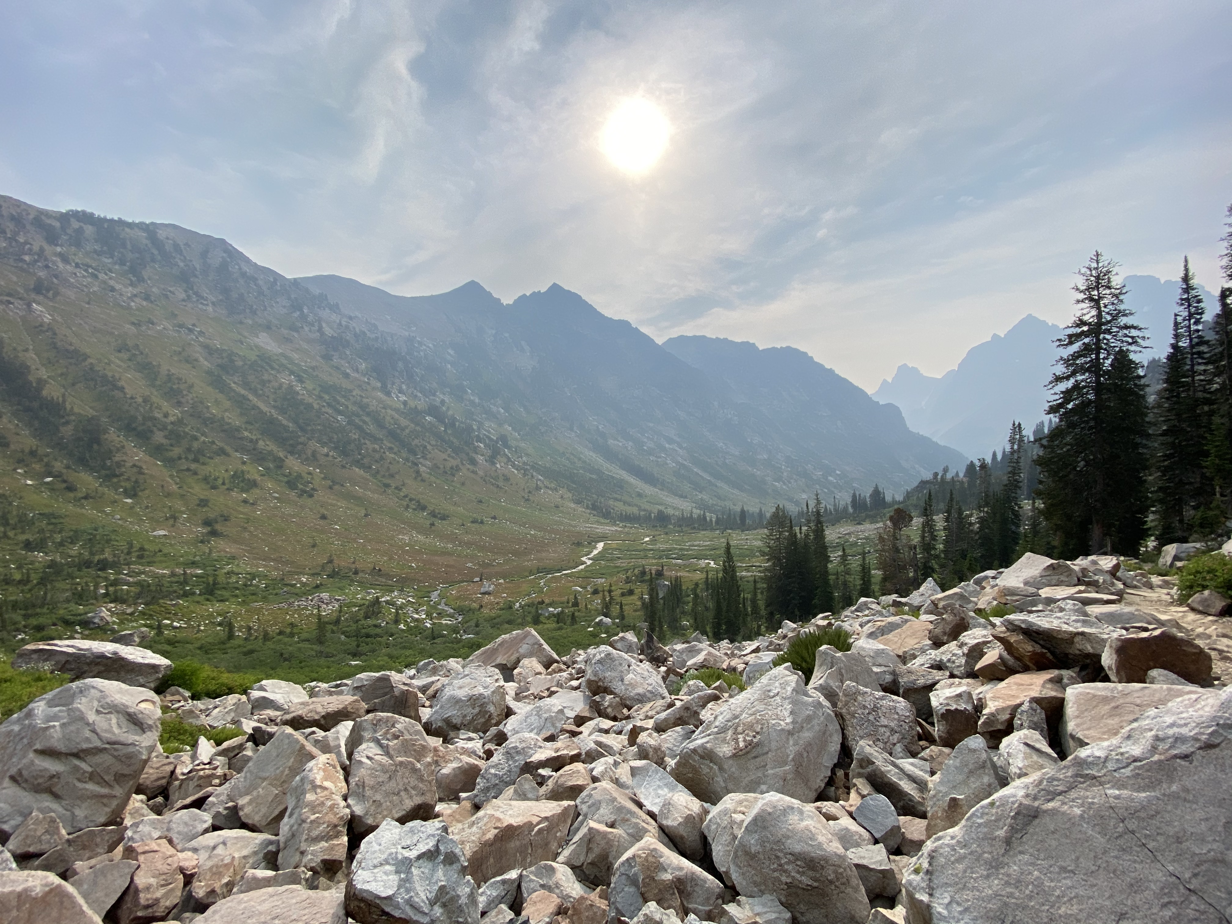
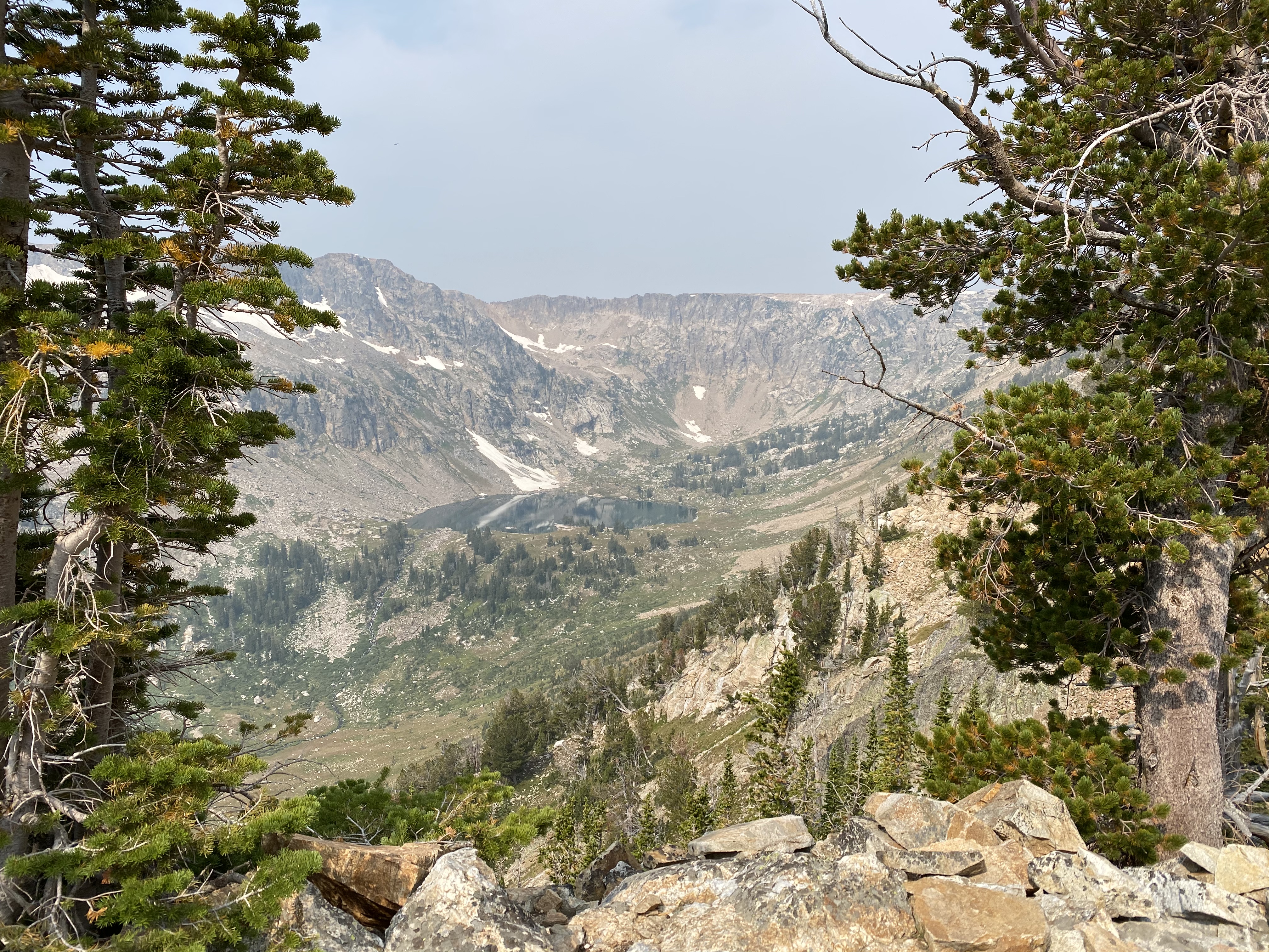
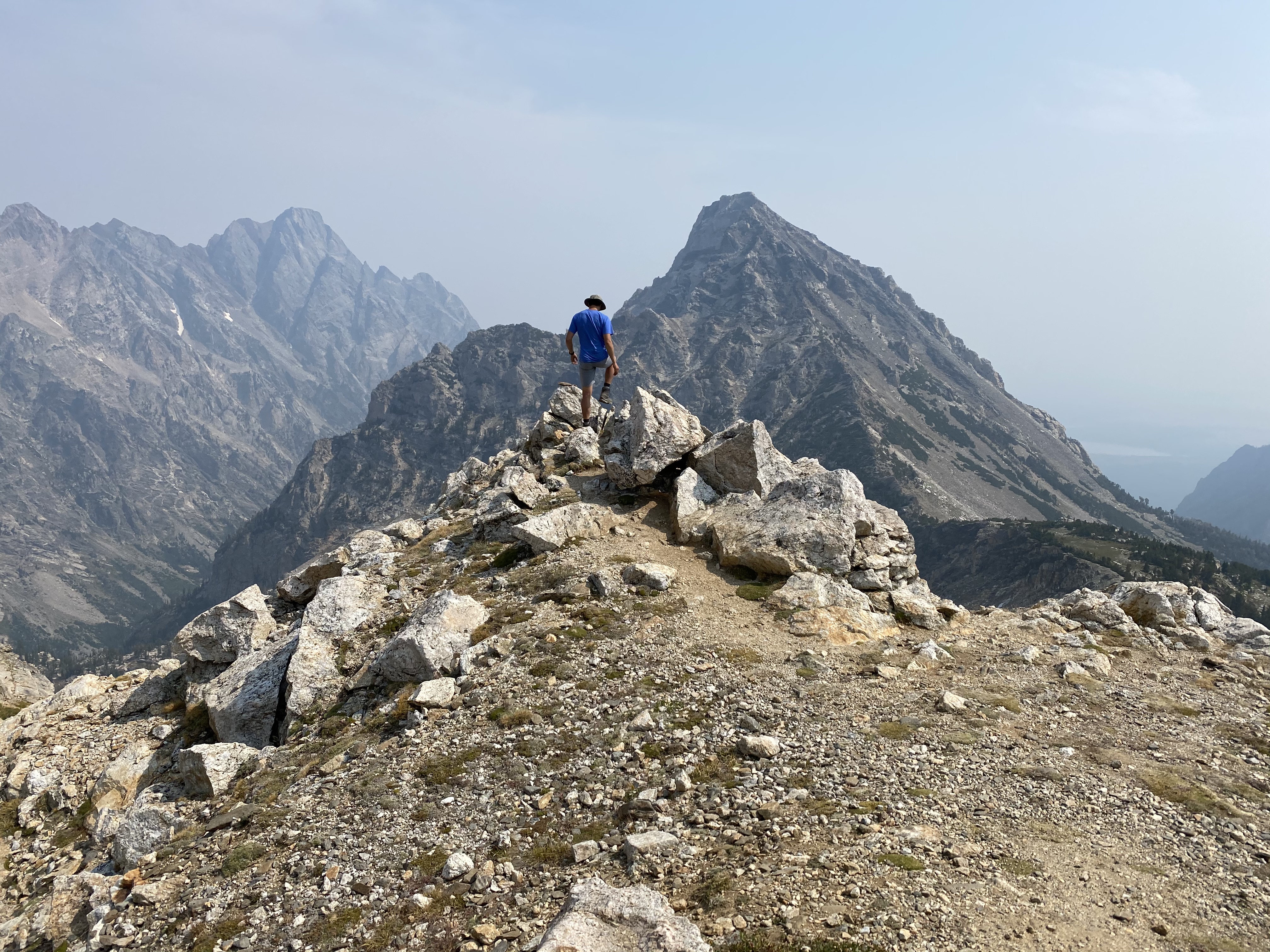
We finally made it to Hurricane Pass! We arrived at around 2:15pm, so it took roughly just under 5 hours to get here from Death Canyon Shelf. It's quite possibly the best view the the primary Teton mountains (Grand Teton, Middle Teton and South Teton). You can also get a nice view of Schoolroom Glacier, or at least what's left of it.
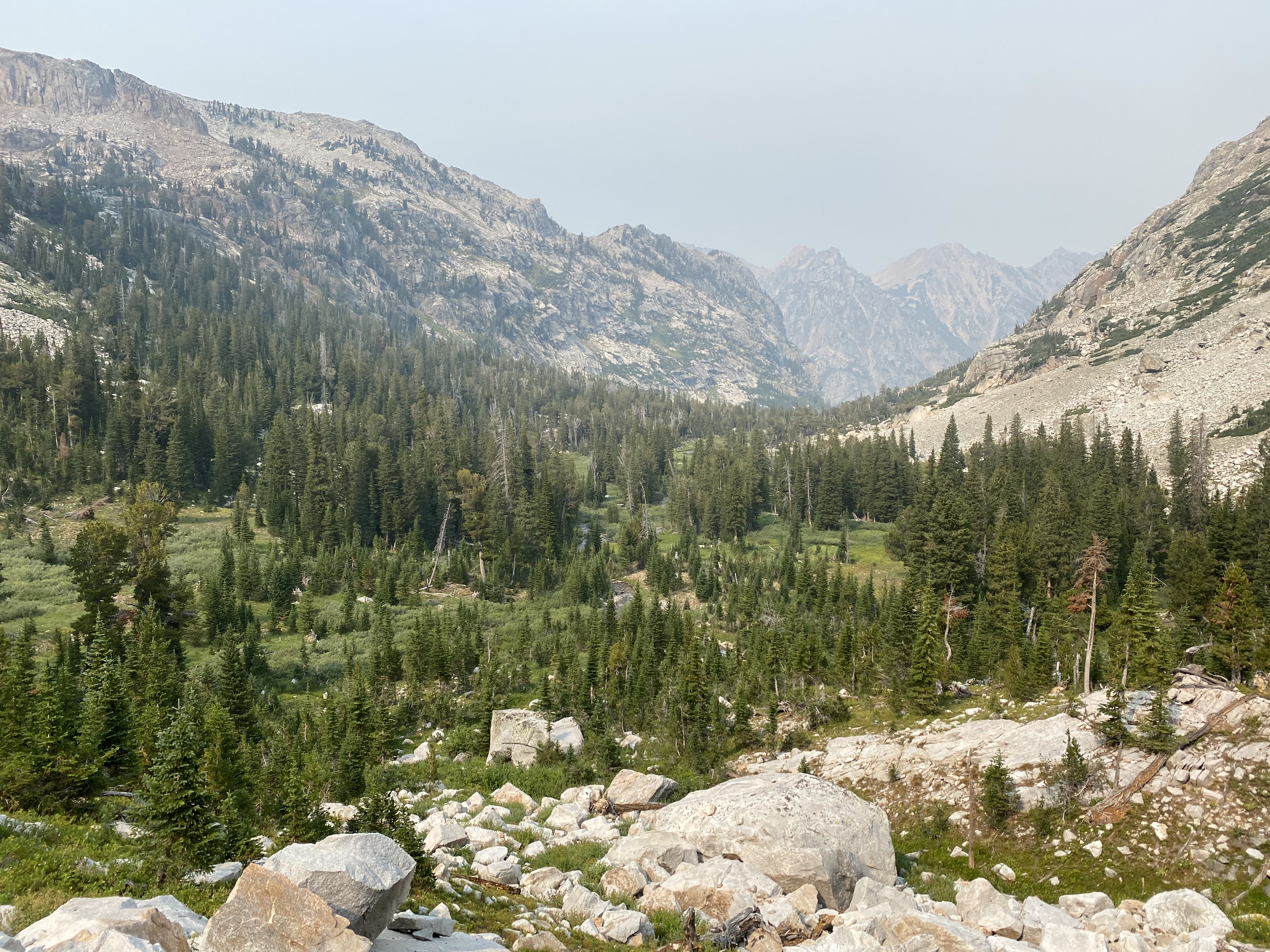
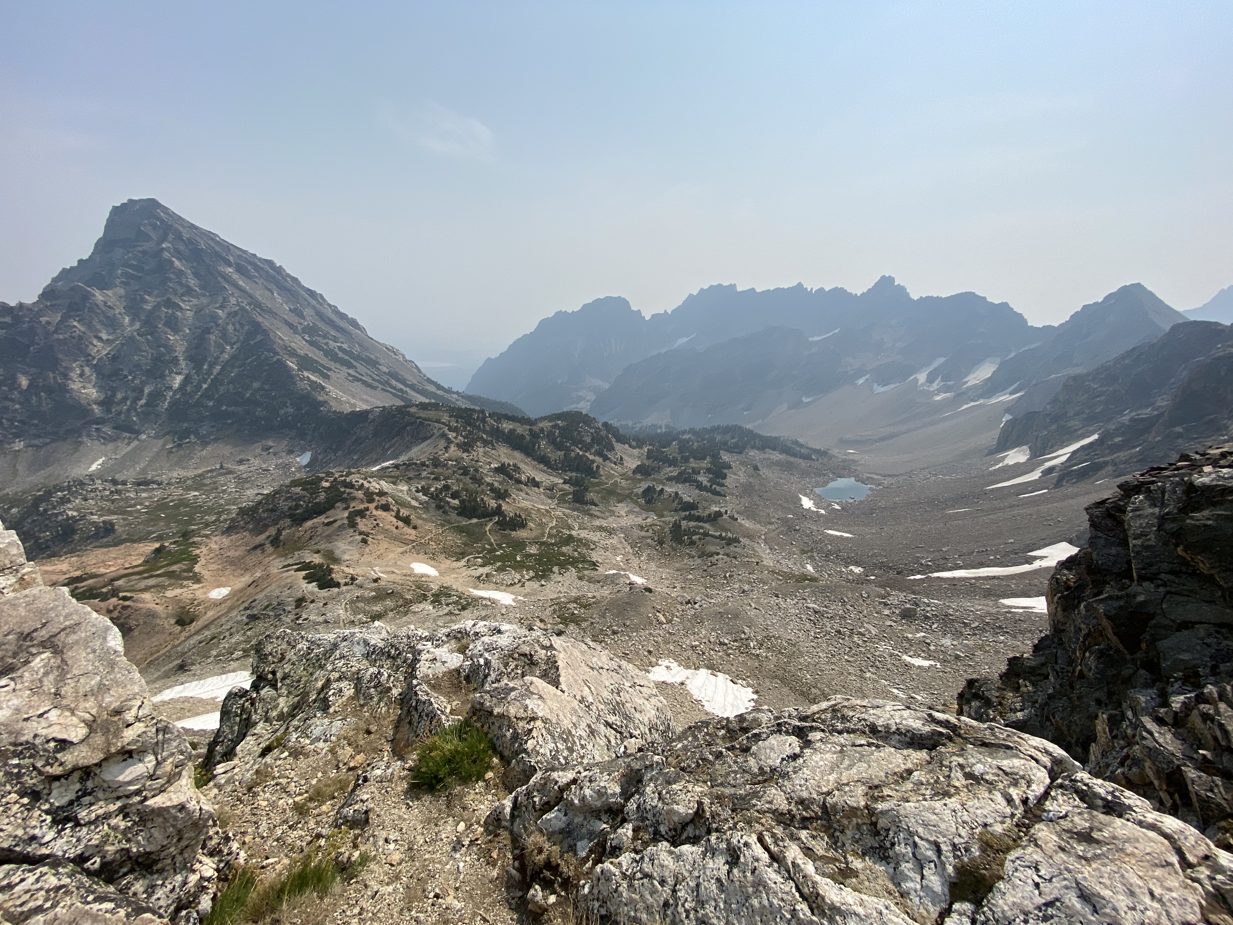
From here it's just a short hike down into the the South Fork Cascade Canyon to find camp. Depending on where you stop, it's roughly 3-5 miles in distance and 1,500-2,000ft of descent. There are a lot of camping options in South Fork Cascade Canyon. It's a really nice area with a creek running through the entire canyon, so you really don't have to worry about water.
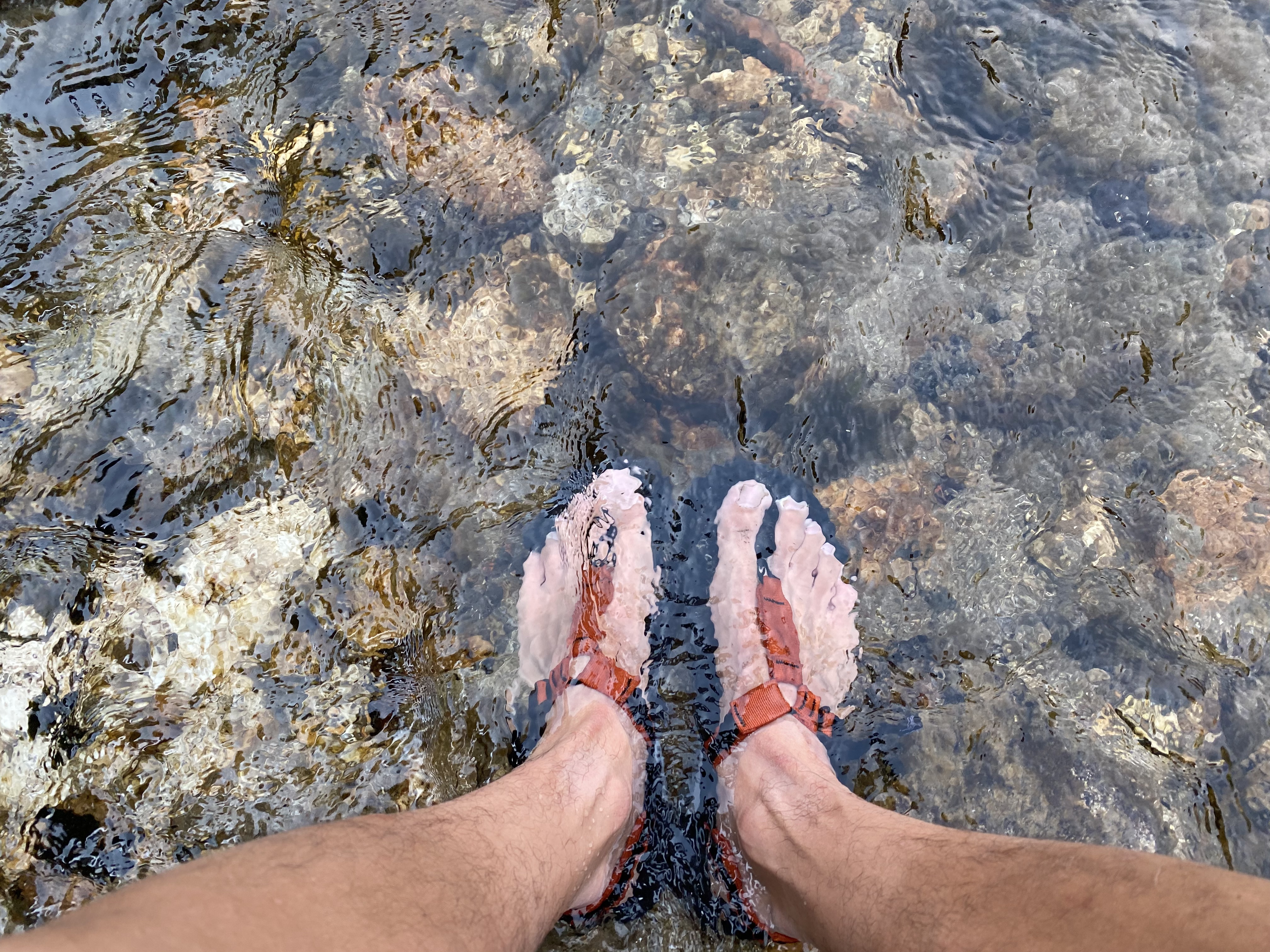
Well, it didn't take long to find a good campsite. We found a really nice open spot in the trees next to the creek. we arrived at this campsite at around 4:00pm, dipped out feet in the creek, has some diner and chilled out for the rest of the night.
Day 3: South Fork Cascade Canyon to Holly Lake
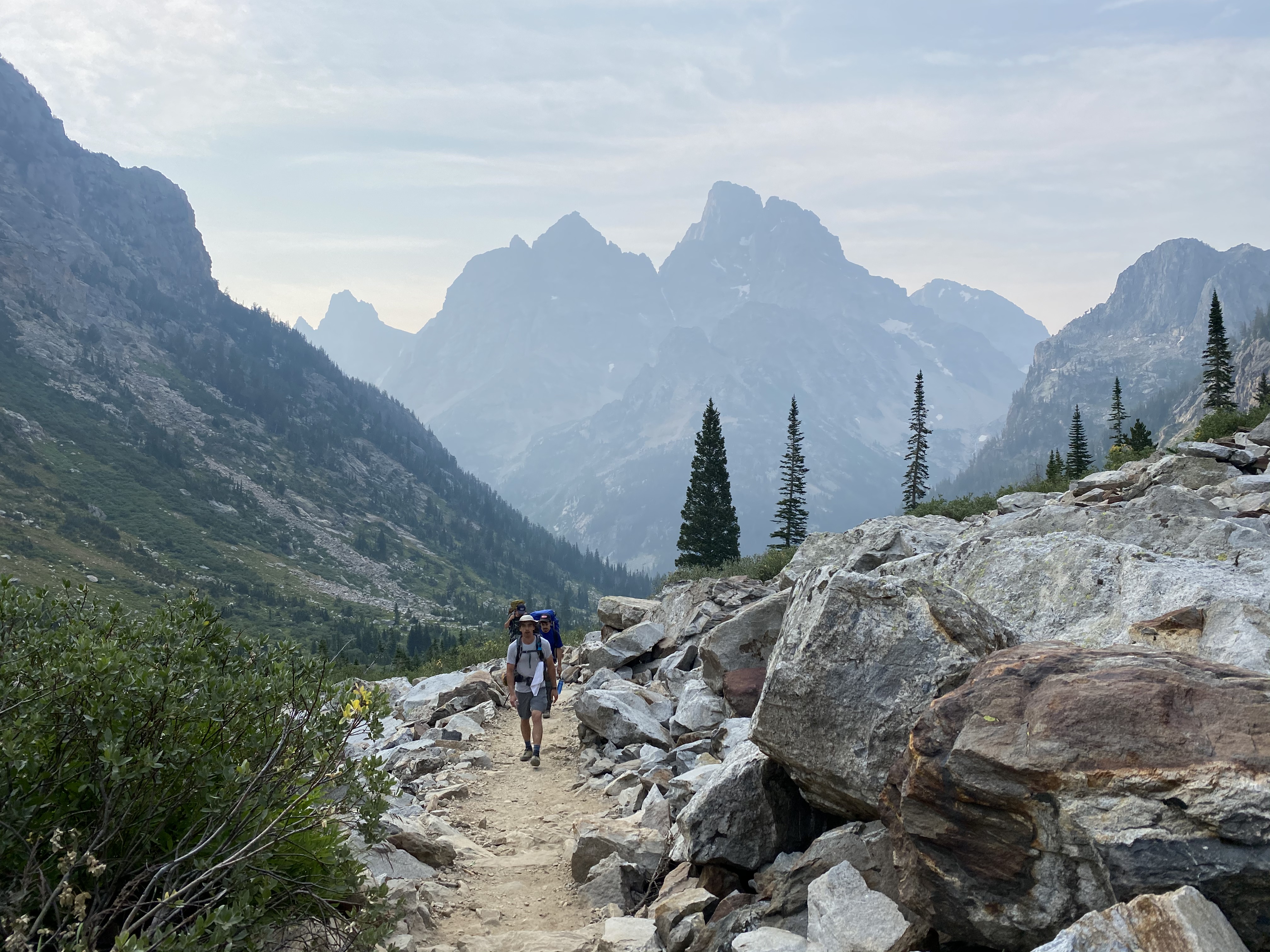
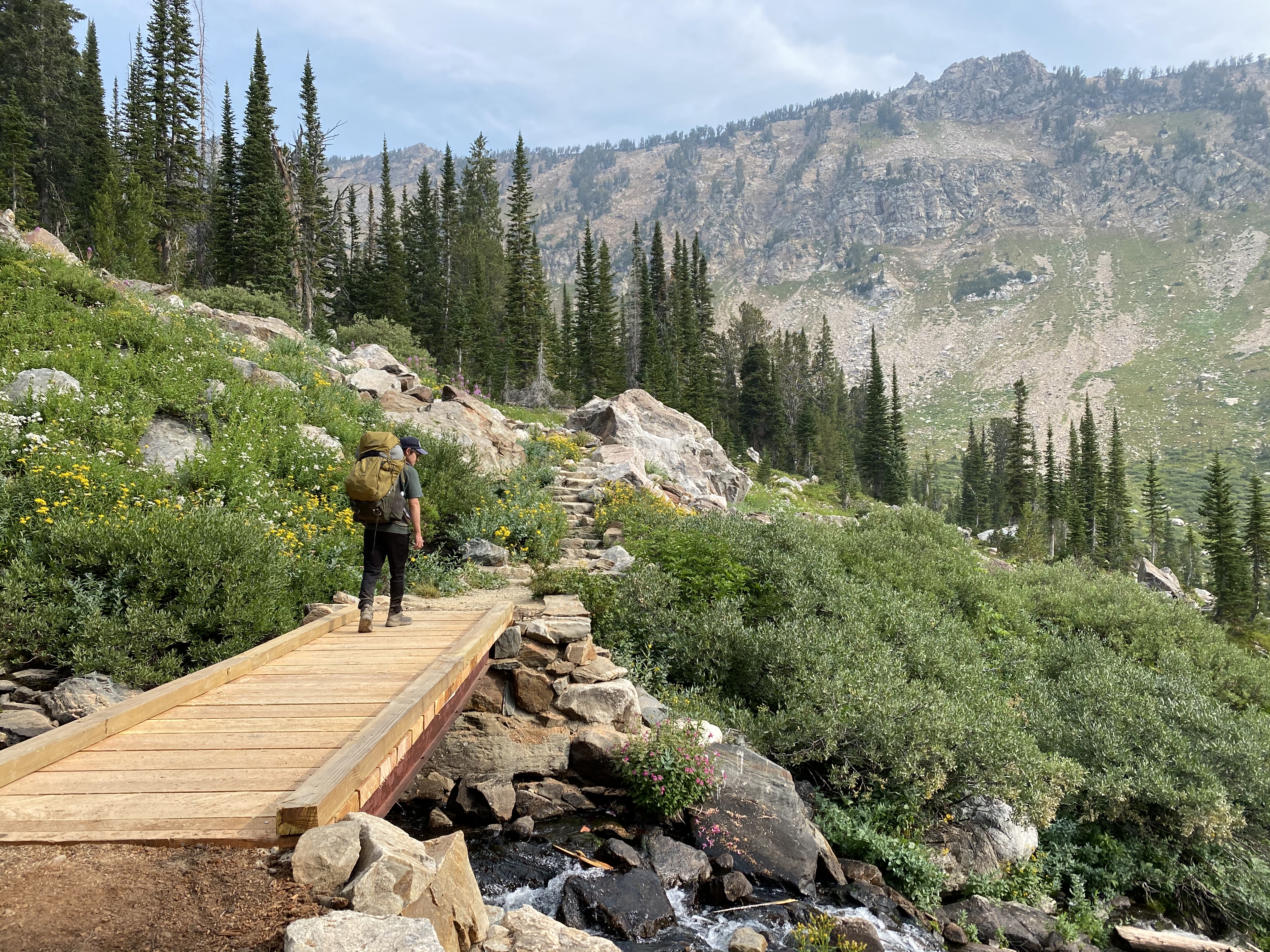
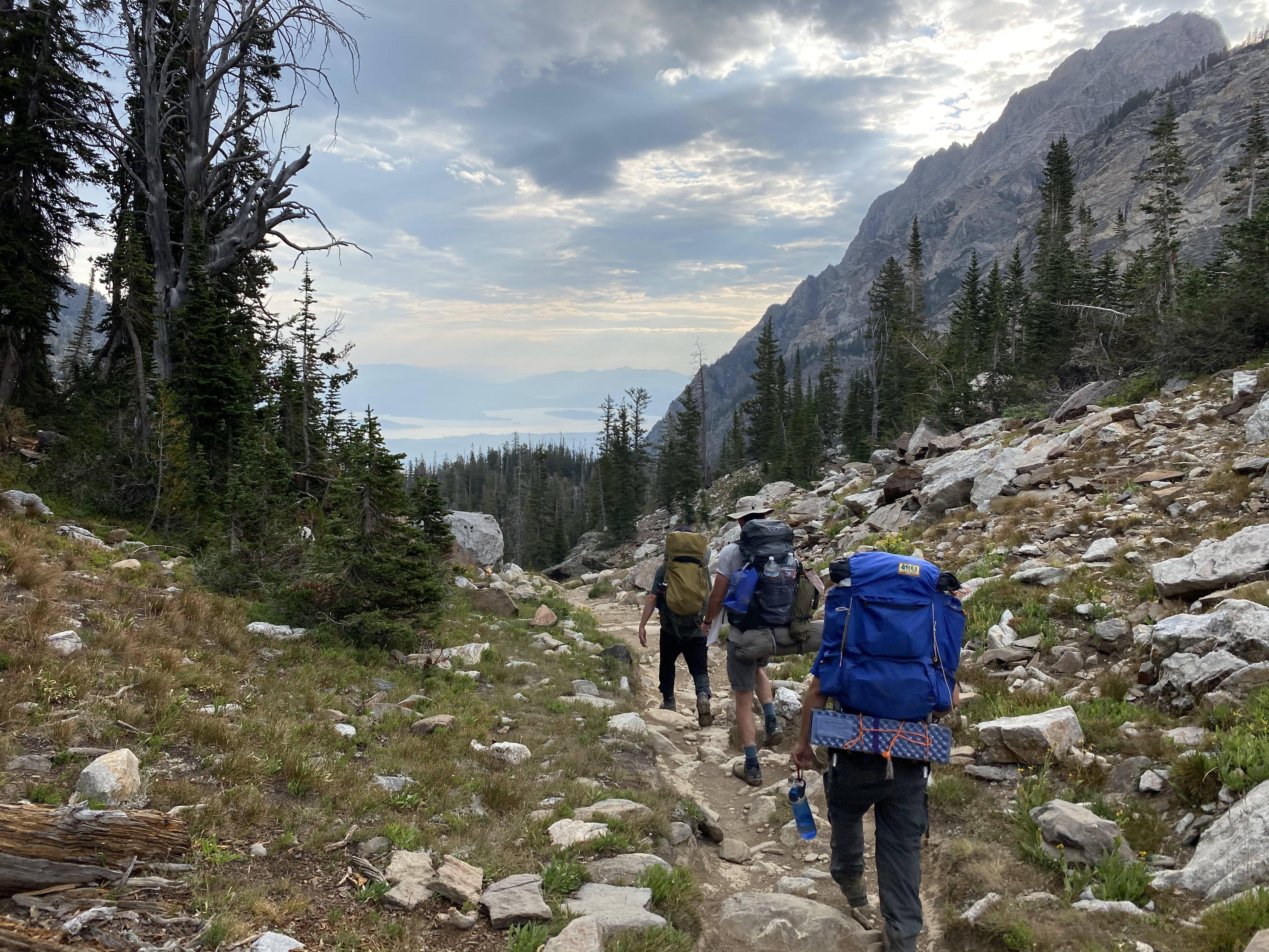
This was going to be another big day. The bottom of South Fork Cascade Canyon is pretty much the low point of the entire trail. Well, to be specific... The South Fork Cascade Creek Canyon meets with the proper ("north fork") Cascade Canyon, and this is where the Cascade Canyon trail leads out of the valley to Jenny Lake. This point where the valley forks, is technically the low point. It's about 2.8 miles from our camp at South Fork Cascade Canyon and, sits at about 7,860ft elevation.
We went to bed pretty early last night, so we got an early start. We were packed up and ready to go by 6:45am, and we got to enjoy some beautiful early morning dawn light as we hiked out of the canyon. The start of the day was really chill. The trail was mostly flat and going slightly downhill, to that low point I mentioned, which meant we would eventually be going up.
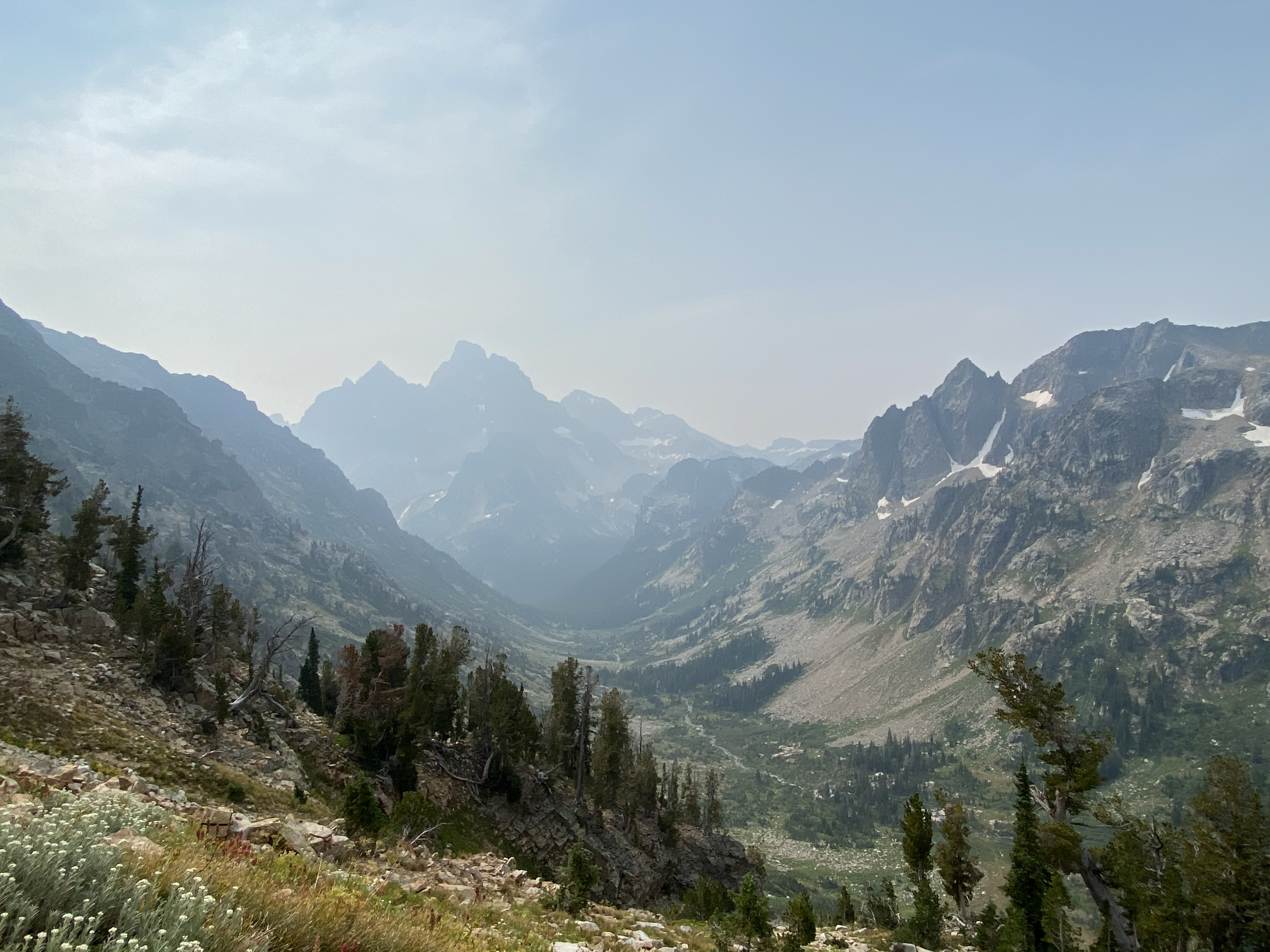
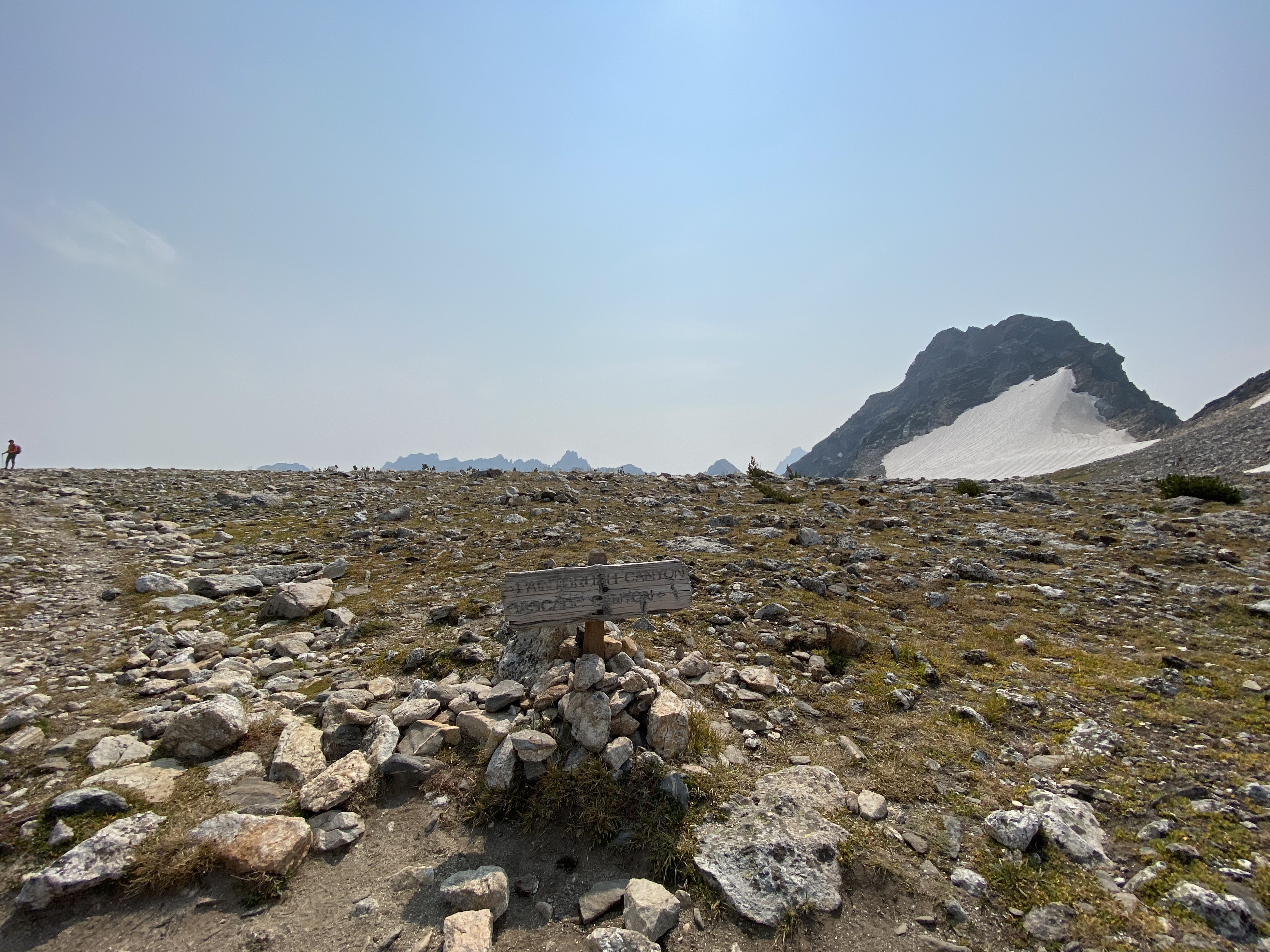
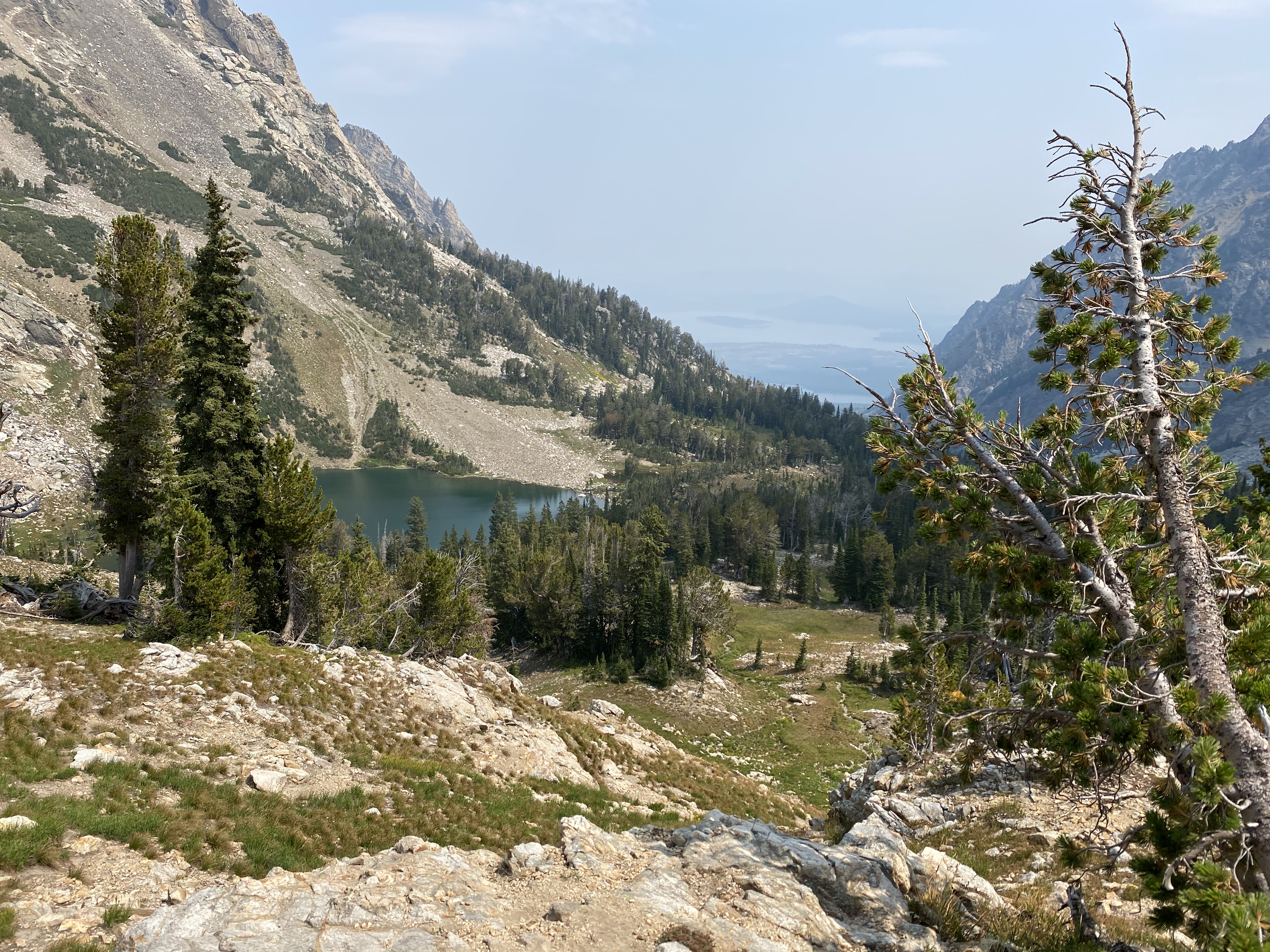
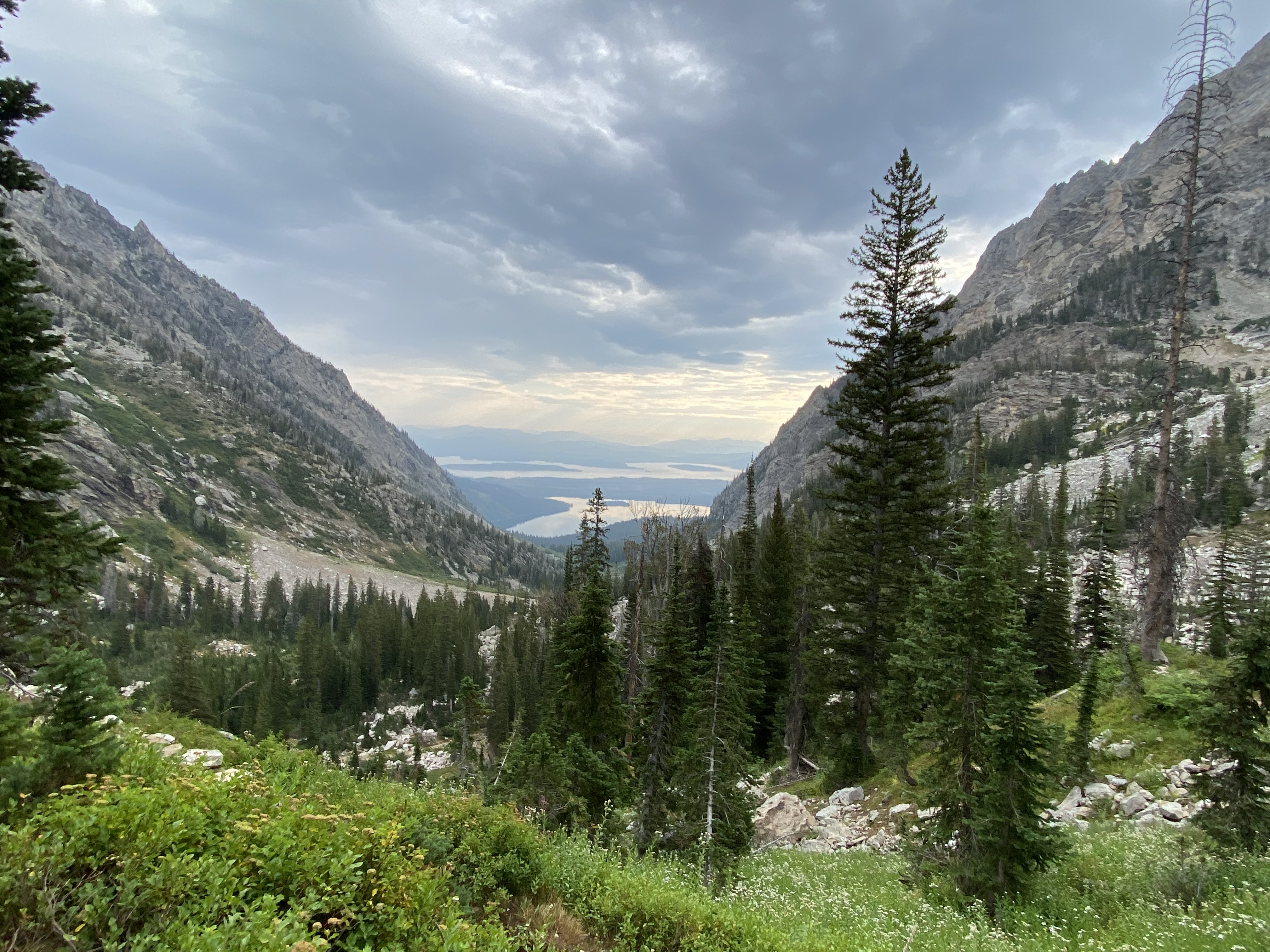
Once we got to that low point, we could see the valley leading out to Jenny Lake, back to civilization. Luckily for us, we were heading back up into the mountains! Up towards Lake Solitude, Paintbrush Divide and eventually, Holly Lake. The trail starts to slowly ascend, and from Lake Solitude to Paintbrush Divide might have been my favorite section of the entire trail. It's about 4 miles and 1,180ft of elevation gain from the low point to Lake Solitude.
This section of the Teton Crest Trail is actually following the Lake Solitude Trail. It's absolutely stunning. For a shorter loop, I would strongly recommend starting from Jenny lake, hiking up Lake Solitude via the Cascade Canyon Trail and Lake Solitude Trail. Then, going up to Paintbrush Divide and back down to Jenny Lake via the Paintbrush Canyon Trail. It would be a long day hike, or an easy 1 nighter.
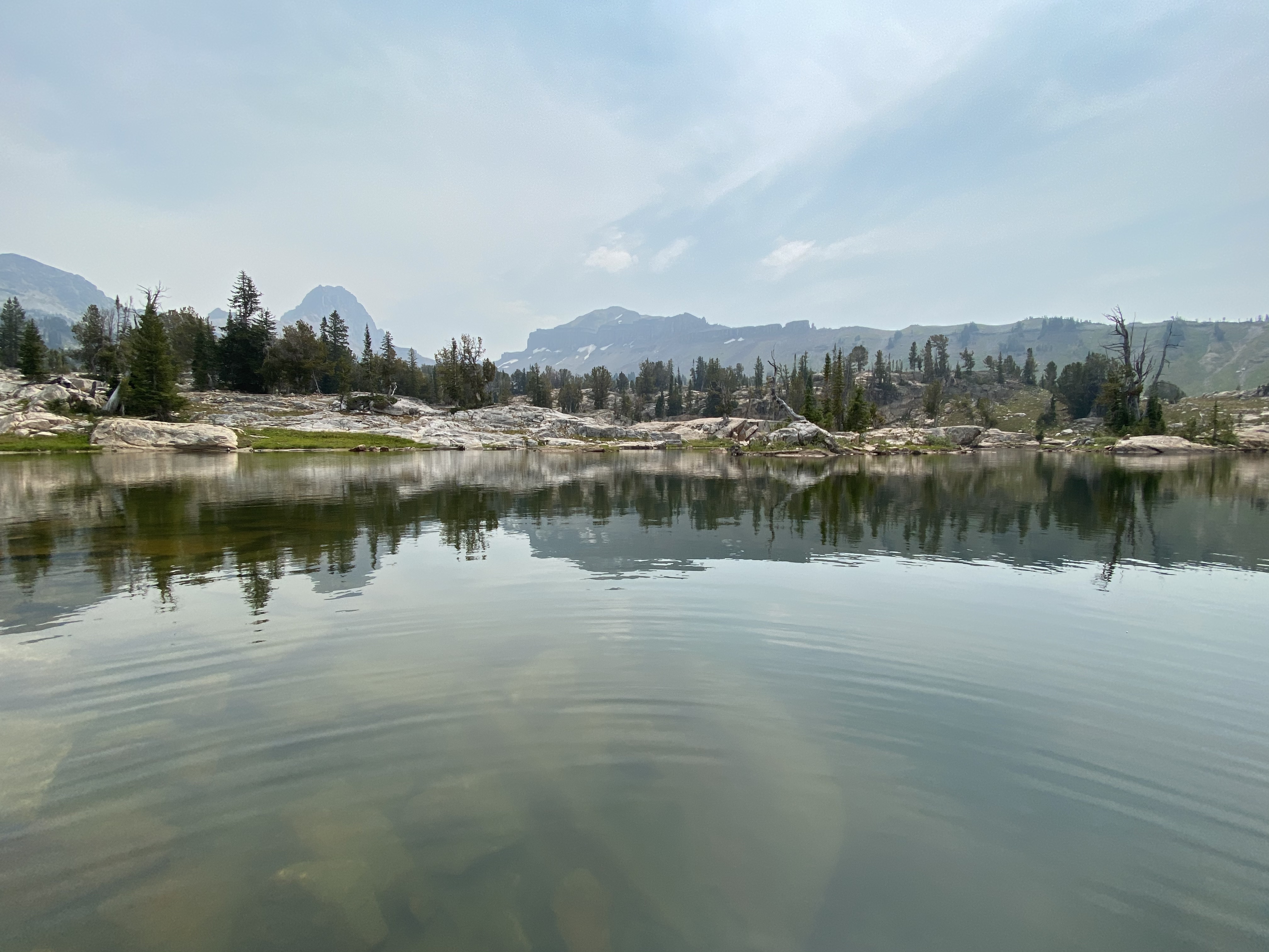
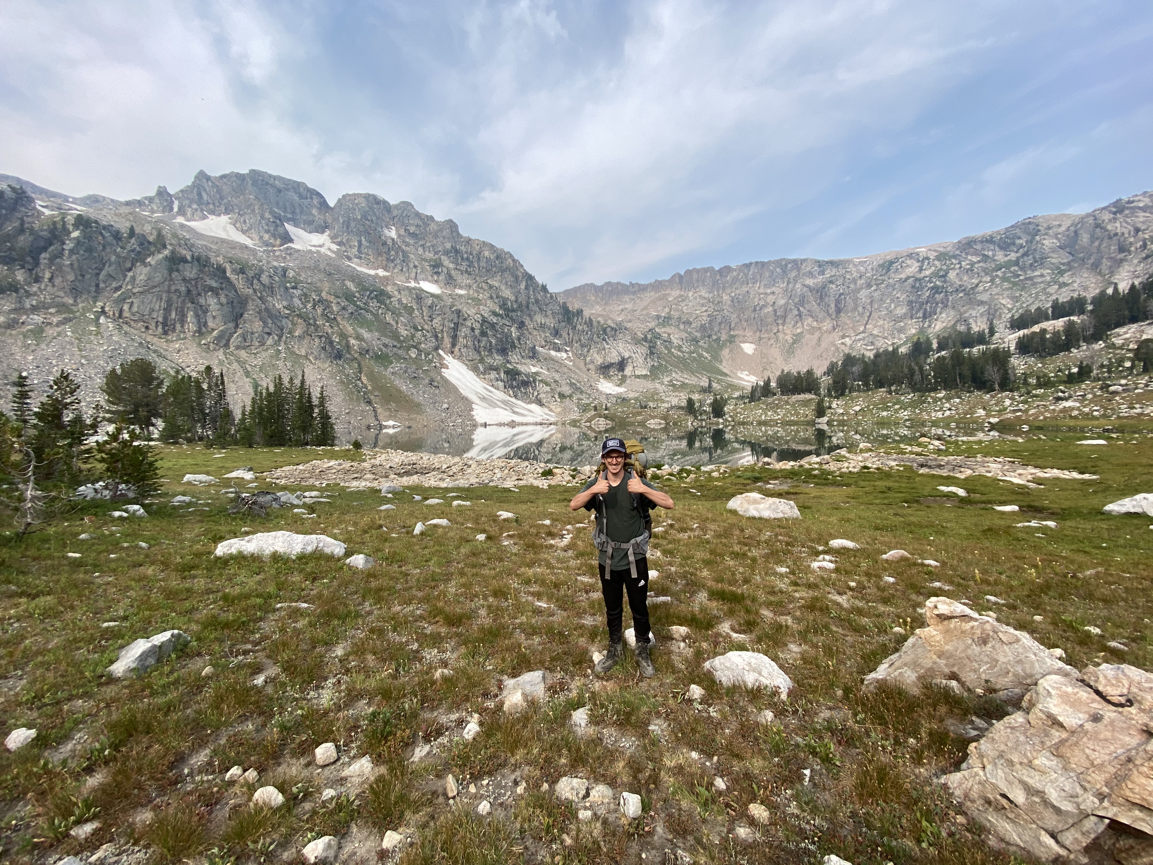
We made it to Lake Solitude! Seriously... This trail is stunning, and it keeps getting better from here. There was no rush because of how enjoyable the hiking was. We arrived at about 9:55am. So, it took us about 3 hours from South Fork Cascade Canyon to get here, not bad! We decided to take a lunch break here and enjoy the scenery.
We didn't hang around for too long since we still have more than half way to go, to get to Holly Lake. From Lake Solitude to the Paintbrush Divide viewpoint is about 2.5 miles and 1,650ft of elevation. The nice views continue!
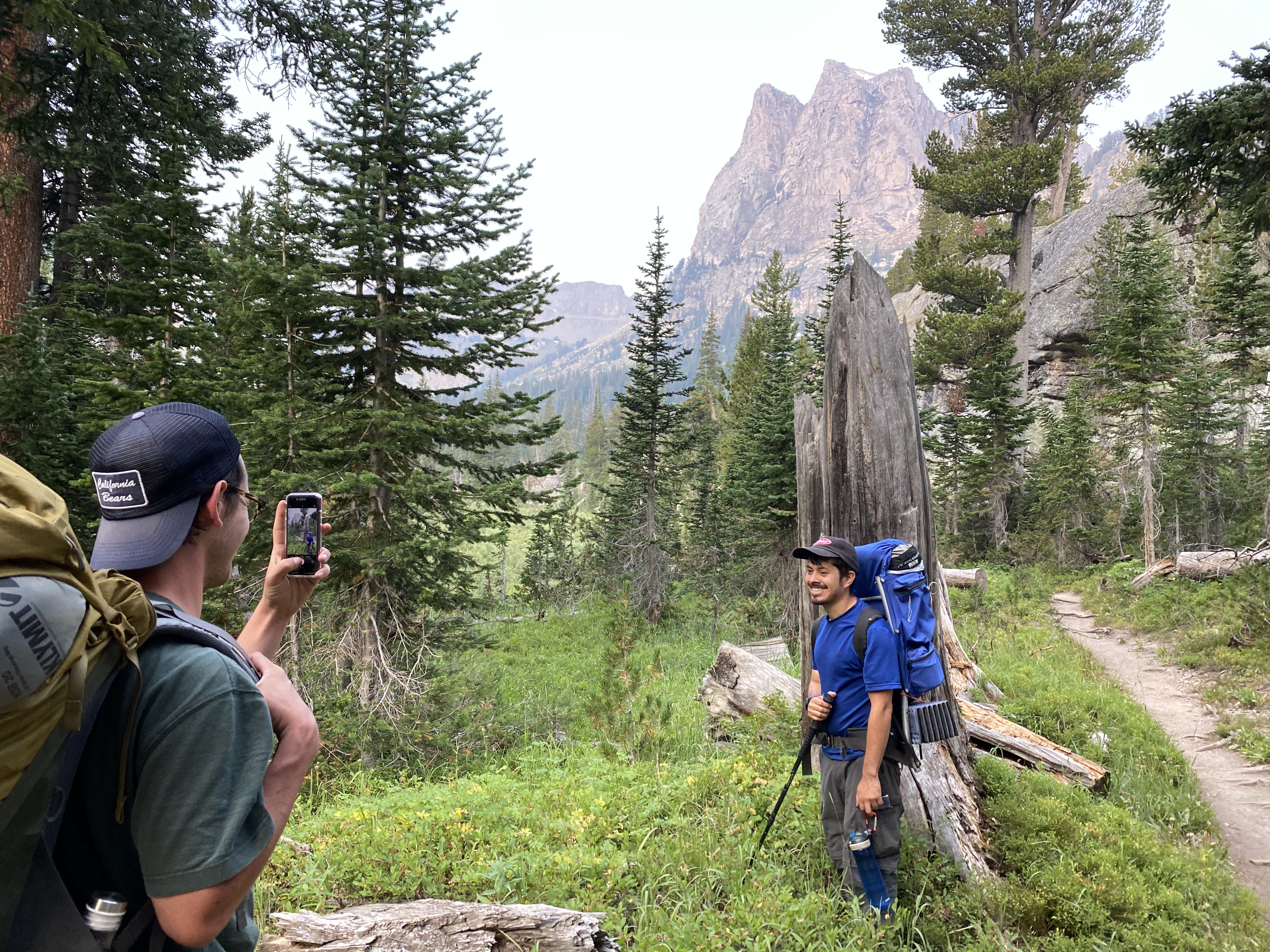
After about 1 hour of hiking, we already made it to Paintbrush Divide. We stopped to take a bunch more photos, as you do.
It didn't take long to reach Holly Lake from the divide, down hill the entire way... and what a nice view of Leigh Lake in the background!
We reached Holly Lake at about 1:15pm. It was a solid 6.5 hour day!
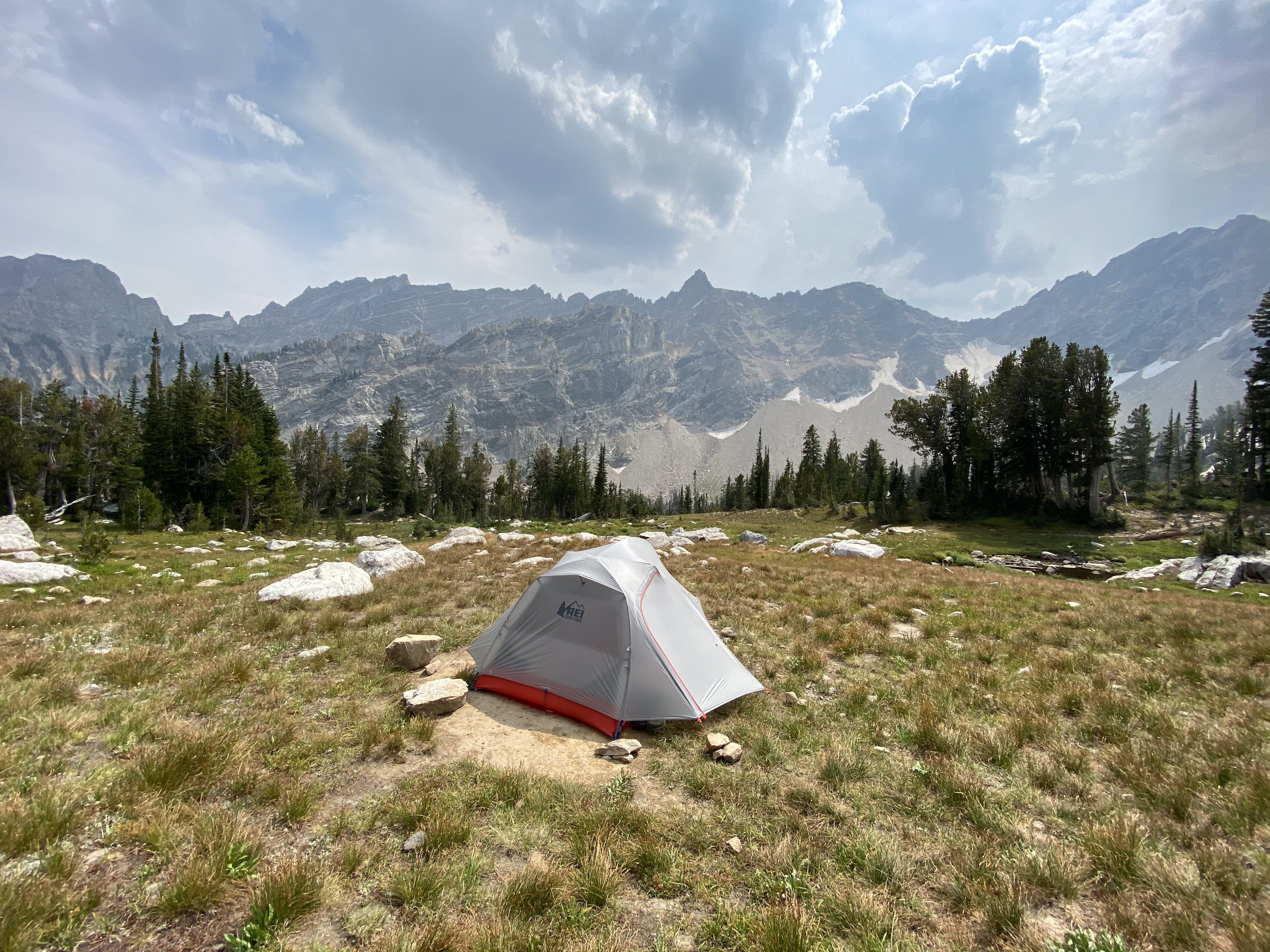
Holly Lake is an incredible camping site. You can either find a spot in the trees or, I actually found a decent spot to setup my tent just on the other side of the patch of trees, down trail from the lake. It was more open and had a nice view of some mountains. The others set up their tents in the patch of trees, where there was also a bear box to store food.
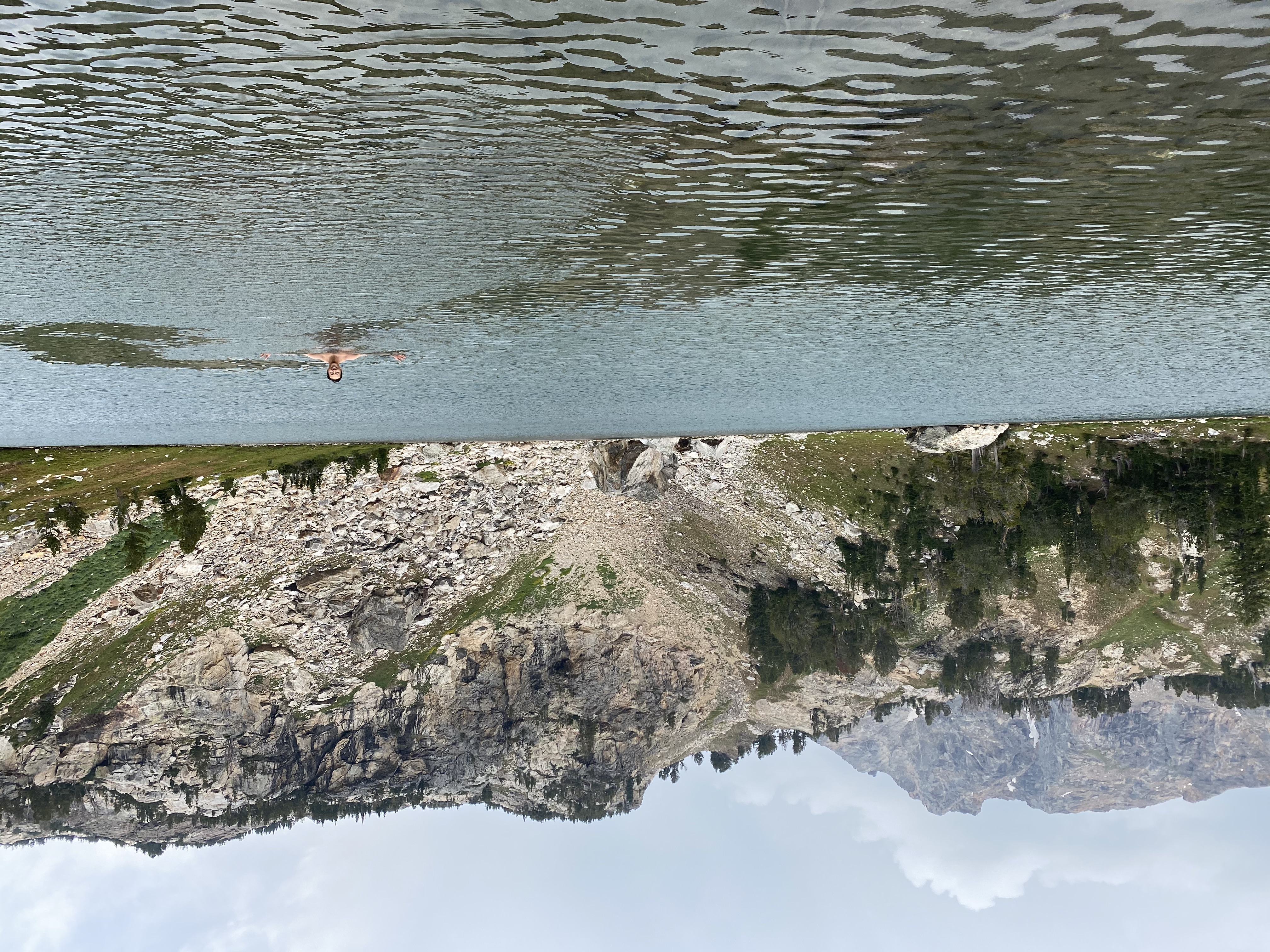
After setting up camp, I went straight into the lake for a refreshing dip!
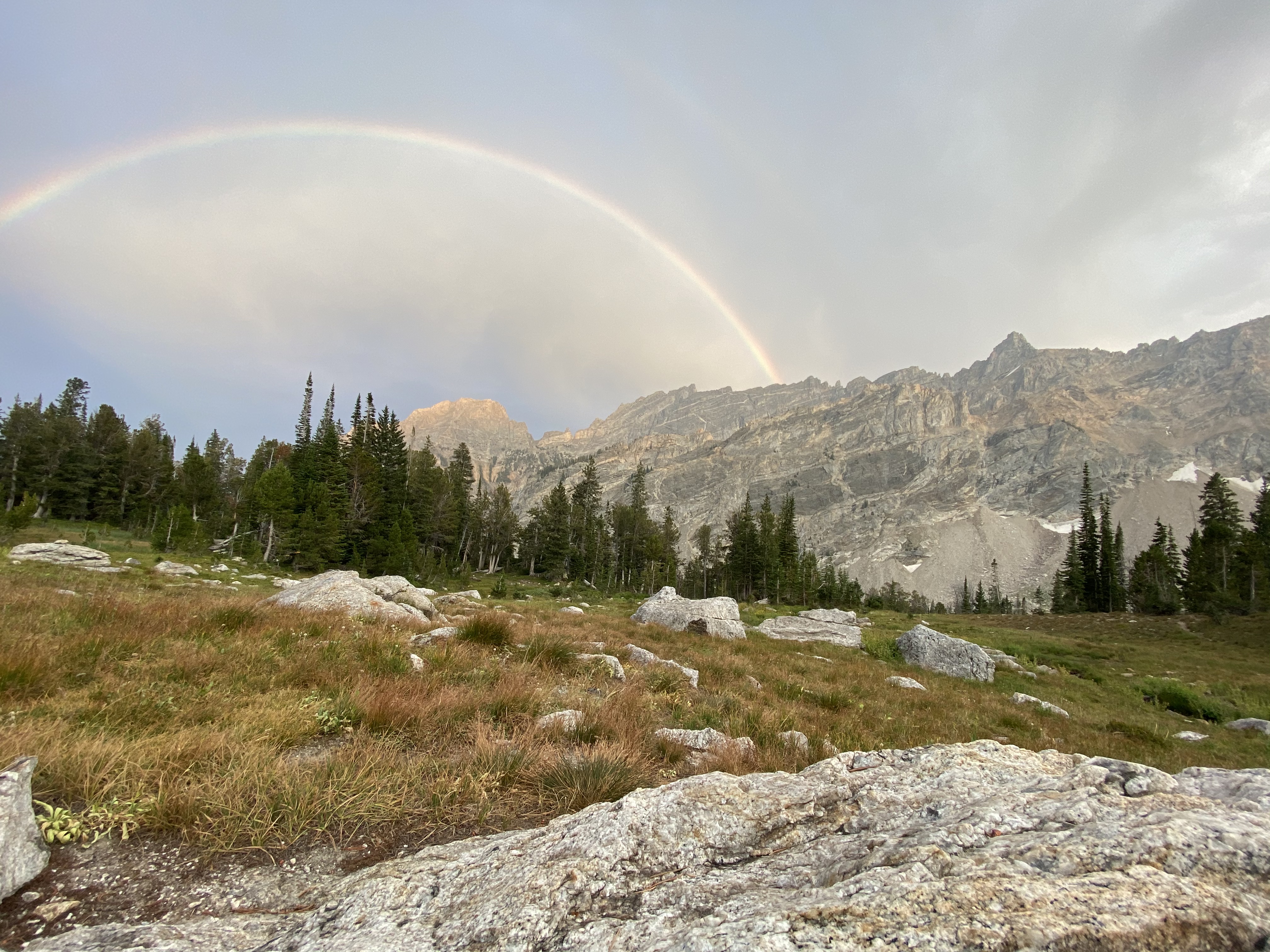
We spent the rest of the time chilling around the lake, having some dinner and enjoying the views. It was a very relaxing end to the day, to say the least. We even got a nice, view of a rainbow!
Day 4: Holly Lake to Jenny Lake with an Inspiration Point Pit Stop
The last day... Personally, I was a bit sad to be ending the trip but, I was also very much so looking forward to a home-cooked meal. We set off around 8:45am, and it was going to be a pretty chill day. From Holly Lake, its all down hill to Jenny Lake.
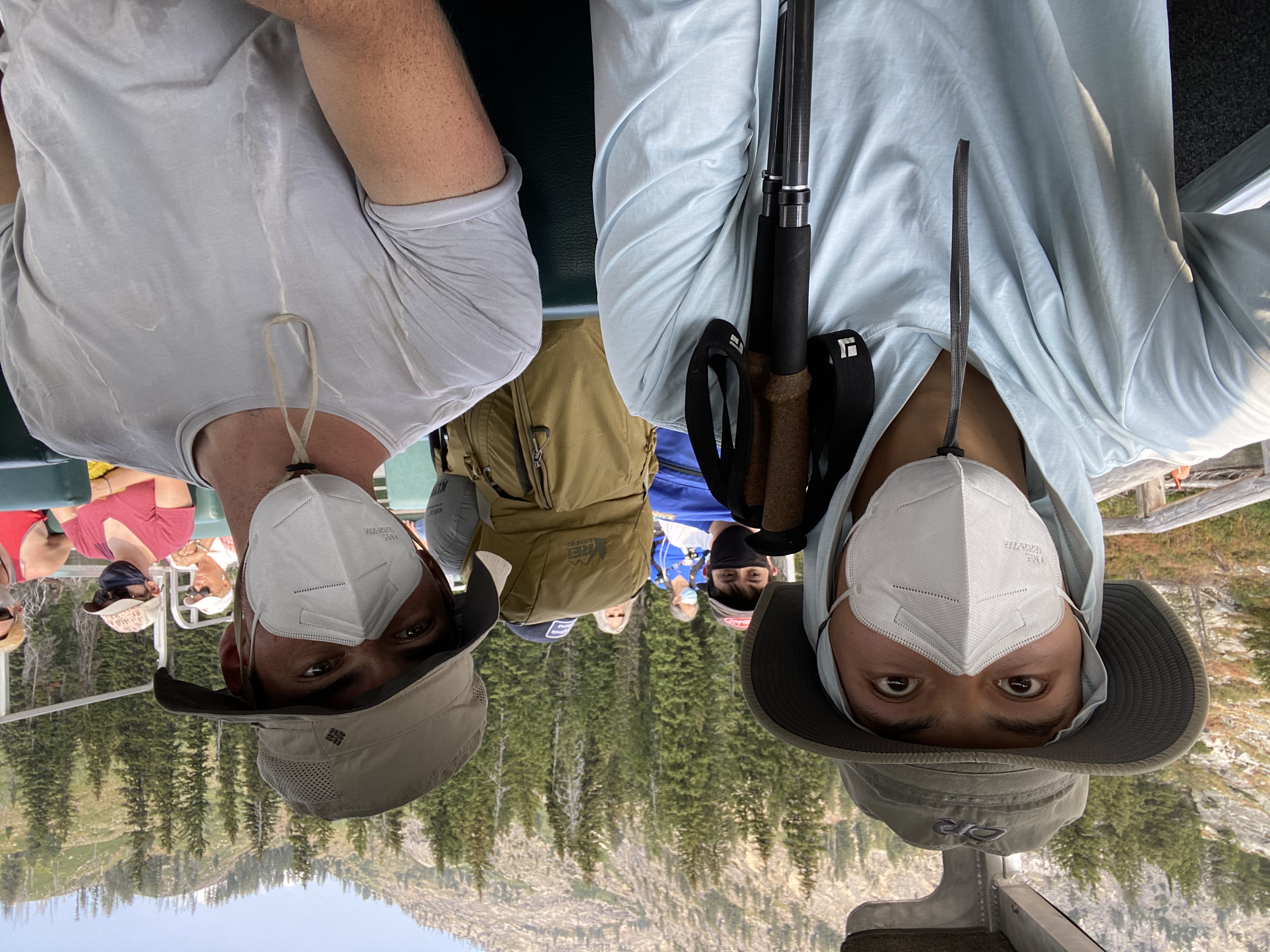
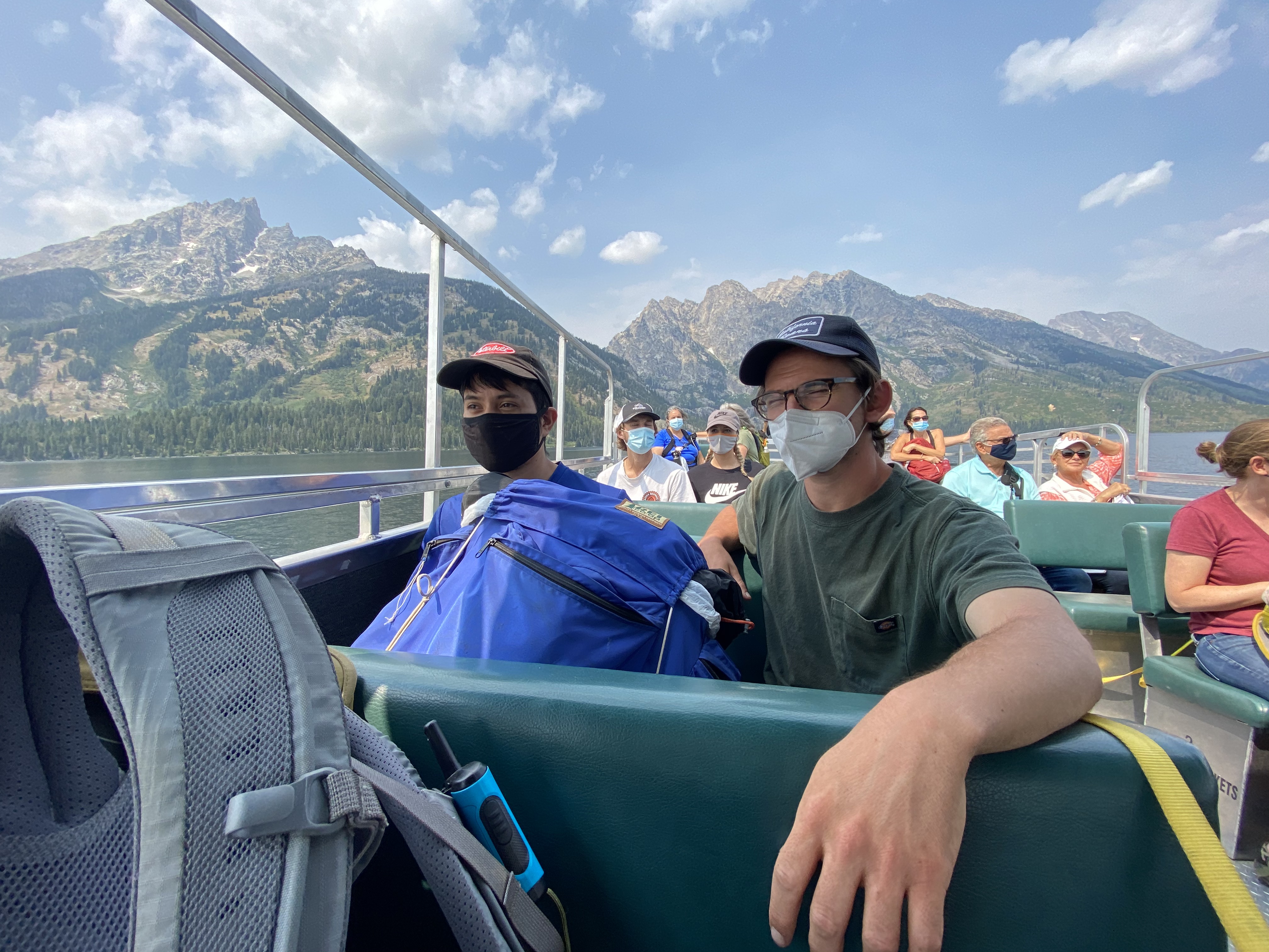
We actually make a last minute decision to try and stop by Inspiration Point, which is on the west side of Jenny Lake. From there, we can take a ferry across to get us back to the Jenny Lake ranger station, where we parked our car.
The rest of the hike wasn't particularly interesting. I'll save you from a bunch more photos. We did in fact see quite a few black bears on our way out though! They seemed pretty normalized to humans, and didn't seem to care about us at all. It was pretty interested.
We got to Inspiration Point at around noon, so it took us just over 3 hours to get there. It was jam-packed with people so, I didn't take too many photos. By this point, we had already taken in so many spectacular views, that Inspiration Point didn't seem all that interesting to be honest.
We were easily able to get a spot on the ferry. We didn't make a reservation and I think it cost us about $10-12 per person. It was a very nice ending to the day, and the trip. The boat ride was super relaxing.
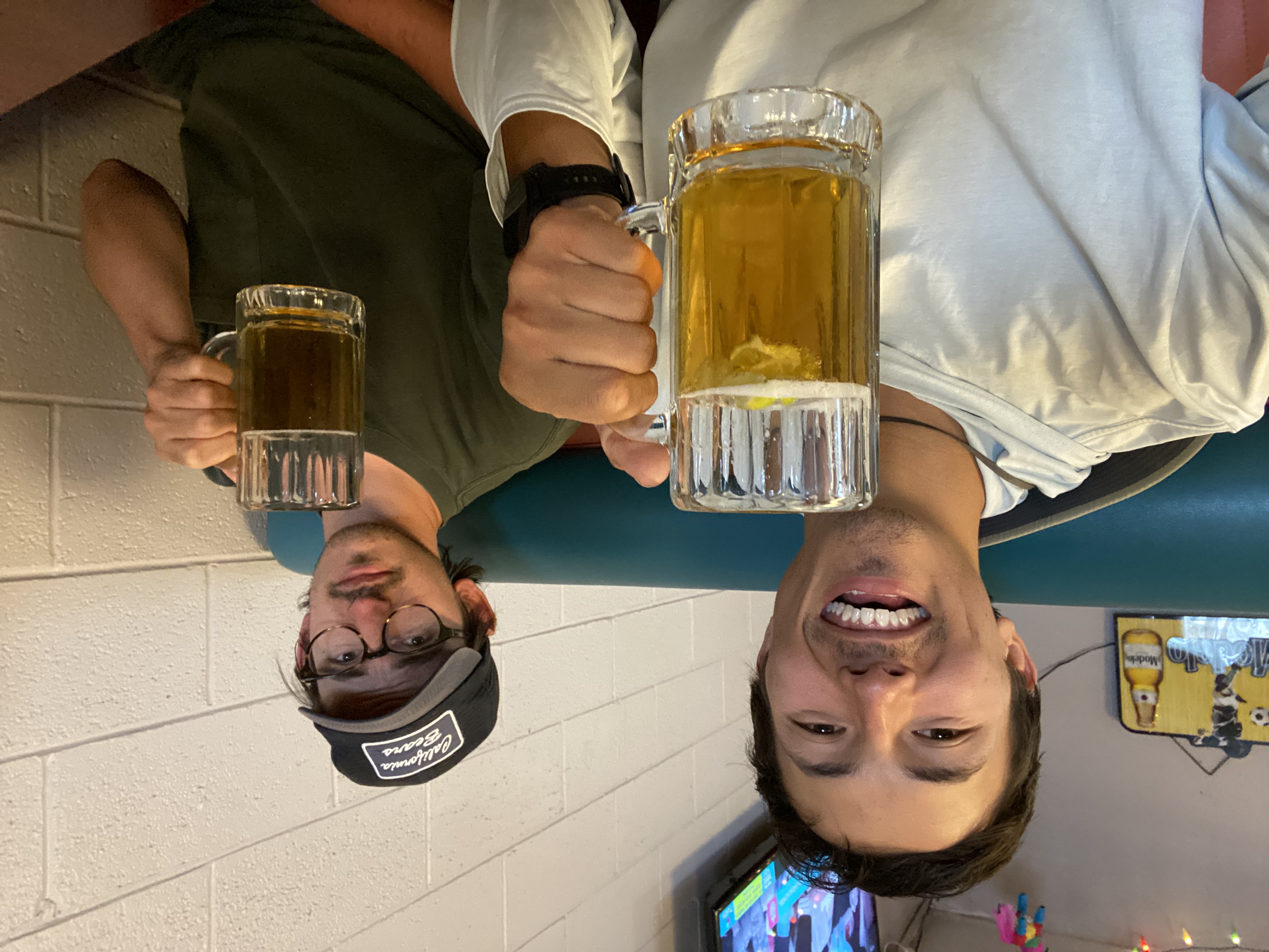
My favorite part about backpacking with these guys is that, we always, always, end our trip with a nice hearty Tex-Mex meal. We found a solid Mexican restaurant in Jackson Hole, and it definitely hit the spot! I'm already looking forward to the next trip!